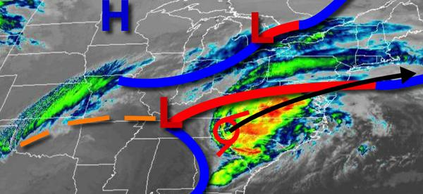
As the remnants of Zeta clashes with a cold front from the Great Lakes, waves of rain and even a bit of snow will continue through tomorrow with gusty winds at times, flash flooding, and slick roadways.
Waves of rainfall will continue throughout the region today, heavy at times. Winds will be from the northeast at 5 to 15 mph. Temperatures will rise into the lower to mid-50s over the interior and mid to upper 50s along the coast for highs.
Waves of rainfall will continue tonight, mixing with snow and sleet at times after midnight over the interior. Winds will back from the northeast to the north at 10 to 20 mph. Temperatures will fall into the 40s and 30s towards daybreak.
A wintry mix of snow, sleet, and rain will mix over to snow and sleet over the interior with minor snow accumulation through the early afternoon. Meanwhile, waves of rainfall will continue along the coast, mixing with a snowflake or two at the end. Winds will back to the northwest at 5 to 15 mph. Temperatures will rise slightly in the early morning hours in the upper 30s to mid-40s and then slowly fall into the 30s for the rest of the day.
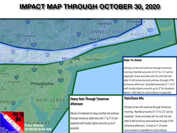
For details on impacts, see the map below.