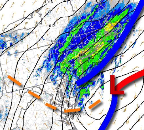
As a storm exits this morning, cold air will invade which will set up chilly conditions for Halloween tomorrow.
An area of low pressure will exit the region this morning with waves of rainfall along the coast while rain will mix over to snow and sleet through the early afternoon. Skies will clear towards this evening. Winds will back to the north at 5 to 15 mph. Temperatures will fall through the 40s and into the 30s today.
High pressure will build into the region tonight through tomorrow with clear skies to scattered cloud cover. Winds will back from the north to the northwest at 5 to 10 mph. Temperatures tomorrow will range from the upper 20s to mid-30s for lows and mid to upper 40s for highs.
A cold front will approach on Sunday with increasing clouds and showers towards evening. Winds will be from the southwest at 10 to 20 mph. Temperatures on Sunday will range from the upper 30s to mid-40s for lows and upper 50s to lower 60s for highs.
Showers will linger in the morning followed by clearing skies on Monday. Temperatures on Monday will range from the mid to upper 30s for lows and lower to mid-40s for highs.
High pressure will be in control Tuesday through Friday with clear skies to scattered cloud cover. Temperatures on Tuesday will range from the upper 30s to lower 40s for lows and upper 40s to lower 50s for highs. Temperatures on Wednesday will range from the upper 30s to lower 40s for lows and upper 50s to lower 60s for highs. Temperatures on Thursday will range from the mid-40s to lower 50s for lows and upper 50s to mid-60s for highs.
Temperatures on Friday will range from the mid-40s to lower 50s for lows and mid to upper 60s for highs.
For details on your location, please visit the Local Seven Day Forecast.