A strong cold front will bring waves of rainfall and windy conditions through this evening, but a tranquil weather pattern is on the way for the upcoming week.
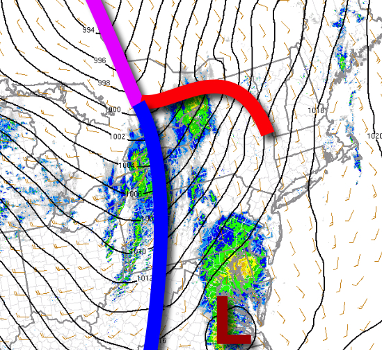
A powerful cold front will move through the region today with waves of showers and a few embedded thunderstorms this afternoon and evening. The rain will be heavy at times with poor visibility expected. Winds will be from the southwest at 10 to 20 mph with gusts over 30 mph at times. Temperatures will rise into the mid-50s to lower 60s for highs.
The low-pressure system will slowly pull away from the region tonight through tomorrow with scattered cloud cover and an isolated rain or snow shower possible. Winds will veer to the northwest at 15 to 25 mph with gusts over 30 mph at times. Temperatures tomorrow will range from the mid to upper 30s for lows and lower to mid-40s for highs.
High pressure will build into the region on Tuesday with clearing skies. Winds will be from the northwest at 5 to 15 mph. Temperatures on Tuesday will range from the upper 30s to lower 40s for lows and upper 40s to lower 50s for highs.
High pressure will be in control Wednesday through Sunday with clear skies to scattered cloud cover. Temperatures will moderate through the period. Temperatures on Wednesday will range from the mid to upper 30s for lows and upper 50s to lower 60s for highs. Temperatures on Thursday will range from the lower to mid-40s for lows and lower to mid-60s for highs. Temperatures on Friday will range from the upper 40s to lower 50s for lows
and mid to upper 60s for highs. Temperatures on Saturday will range from the upper 40s to lower 50s for lows and upper 60s to lower 70s for highs.
For details on your location, please visit the Local Seven Day Forecast.