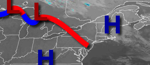
A warm and tranquil weather pattern is settling in as high pressure takes control for the rest of this week and into the weekend.
As a warm front lift north today, high pressure will continue to gain control with clear skies to scattered cloud cover. Winds will be from the southwest at 5 to 10 mph. Temperatures will rise into the upper 50s to lower 60s for highs.
High pressure will be in control tonight through Friday with clear skies to scattered cloud cover. Winds will be from the southwest at 5 to 15 mph. Temperatures tomorrow will range from the mid-40s to lower 50s for lows and lower to mid-60s for highs. Temperatures on Friday will range from the upper 40s to mid-50s for lows and mid to upper 60s for highs.
High pressure will remain in control Saturday through Tuesday with clear skies to scattered cloud cover. Temperatures on Saturday will range from the mid to upper 40s for lows and upper 60s to lower 70s for highs. Temperatures on Sunday will range from the lower to mid-40s for lows and upper 60s to lower 70s for highs. Temperatures on Monday will range from the mid-40s to lower 50s for lows and mid to upper 60s for highs.
Temperatures on Tuesday will range from the mid to upper 50s for lows and mid-60s to lower 70s for highs.
A cold front will approach the region on Wednesday with showers in the afternoon and evening. Temperatures on Wednesday will range from the mid to upper 50s for lows and mid-60s to lower 70s for highs.
For details on your location, please visit the Local Seven Day Forecast.