After a foggy start to the day, excellent weather conditions will be in place by this afternoon. A Spring-like weather pattern returns, but don't get too used to these pleasant conditions.
After some locally dense fog this morning, scattered clouds are expected by this afternoon. Winds will be from the southwest at 5 to 10 mph. Temperatures will rise into the lower to mid-60s for highs.
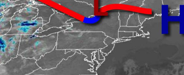
High pressure will be in control tonight through Saturday with a threat for fog in the morning followed by clearing skies in the afternoon. Winds will be from the southwest at 5 to 10 mph. Temperatures tomorrow will range from the upper 40s to mid-50s for lows and mid to upper 60s for highs. Temperatures on Saturday will range from the mid to upper 40s for lows and upper 60s to lower 70s for highs.
High pressure will remain in control Sunday through Tuesday with clear skies to scattered cloud cover along with the threat for some morning fog. Temperatures on Sunday and Monday will range from the mid to upper 40s for lows and mid-60s to lower 70s for highs. Temperatures on Tuesday will range from the mid-50s for lows and mid-60s to lower 70s for highs.
A cold front will slowly move through the region on Wednesday and Thursday with periods of showers, heavy at times. Temperatures on Wednesday will range from the upper 50s to lower 60s for lows and mid-60s to lower 70s for highs. Temperatures on Thursday will range from the upper 40s to lower 50s for lows and mid-50s to lower 60s for highs.
For details on your location, please visit the Local Seven Day Forecast!