Waves of rainfall today signals the start of a more active and colder weather pattern through next week.
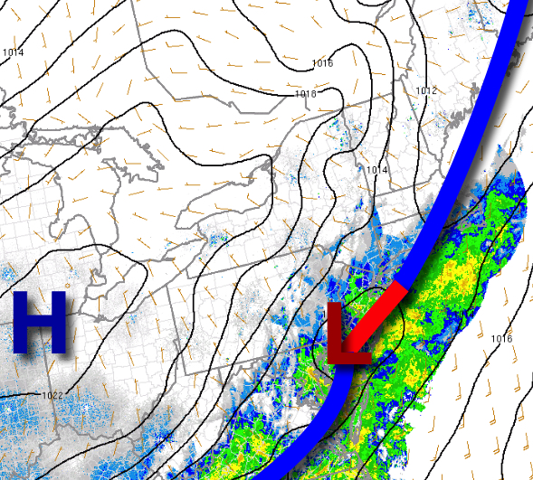
An area of low-pressure and a slowly moving cold front will produce waves of rainfall along the coast and scattered showers over the interior through this afternoon. Winds will back to the northwest at 5 to 15 mph. Temperatures will rise into the mid to upper 50s for highs today.
The cold front will linger over the coastal waters with a wave of low-pressure tonight through tomorrow with broken cloud cover and isolated to widely scattered showers. Winds will veer to the northeast at 5 to 15 mph. Temperatures tomorrow will range from the mid-40s to lower 50s for lows and lower to mid-50s for highs.
High pressure will build into the region tomorrow evening through Saturday with clear skies to scattered cloud cover. Winds will back to the west at 5 to 15 mph. Temperatures on Saturday will range from the mid-30s to lower 40s for lows and mid-40s to lower 50s for highs.
A warm front will follow on Sunday with widely scattered showers. Temperatures on Sunday will range from the upper 30s to mid-40s for lows and upper 50s to lower 60s for highs.
A series of cold fronts will follow on Monday and Tuesday with widely scattered to isolated rain and snow showers. The best potential for snow showers will be in the Poconos and Catskills. Temperatures on Monday will range from the upper 30s to mid-40s for lows and upper 40s to lower 50s for highs. Temperatures on Tuesday will range from the upper 20s to mid-30s for lows and mid-30s to lower 40s for highs.
High pressure will be in control on Wednesday and Thursday with clear skies to scattered cloud cover. Temperatures on Wednesday will range from the mid-20s to lower 30s for lows and mid-30s to lower 40s for highs. Temperatures on Thursday will range from the mid to upper 20s for lows and upper 30s to lower 40s over the interior and mid-40s to lower 50s along the coast for highs.
For details on your location, please visit the Local Seven Day Forecast!