Tranquil and chilly conditions today will give way to the first significant snowfall for the region in two years with the potential for some locations to have snowfall over a foot of snow.
High pressure will pass to the north of the region today with clear skies to scattered clouds. Winds will veer from the northwest to north at 5 to 15 mph. Temperatures will rise into the upper 20s to lower 30s over the interior and mid to upper 30s along the coast for highs.
High pressure will exit tonight with increasing clouds towards morning. Winds will veer from the north to northeast at 5 to 15 mph. Temperatures will fall into the upper 10s over the interior and lower to mid-20s along the coast for lows.
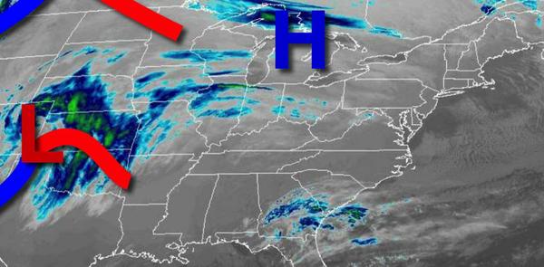
An area of low pressure will approach the region with rain developing over southern New Jersey in the afternoon. As the precipitation lifts northward, the rain will change over to snow for the Philadelphia and New York City metropolitan areas and points northward. Periods of snow, very heavy at times, will continue through the evening for the Philadelphia and New York City metropolitan areas on northward with some sleet mixing in from time to
time. A wintry mix of snow, sleet, and rain will continue for the eastern suburbs of Philadelphia, centra New Jersey, and the south shore of Long Island. Rain will continue for southern New Jersey. Winds will be from the northeast at 10 to 20 mph. Temperatures will rise into the upper 20s over the interior, upper 20s to mid-30s in the Philadelphia and New York City metropolitan areas, and upper 30s to mid-40s along the immediate coast and southern New
Jersey.
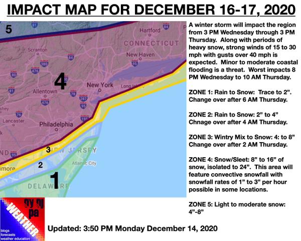
As the low-pressure system passes through the coastal waters tomorrow night through Thursday morning, all precipitation will change over to snow, heavy at times, from northwest to southeast. The snow will exit in the afternoon with clearing skies towards evening. Winds will back from the north to northwest at 15 to 30 mph with gusts over 40 mph at times, subsiding to 5 to 15 mph from the northwest by the evening. Visibility will fall
below a mile at times. Temperatures will fall through the 30s and 20s throughout the day. See the impact map below for details.