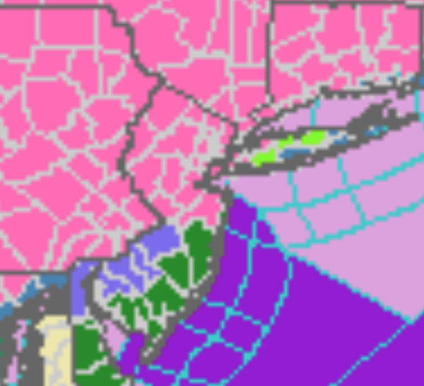
Updated Winter Storm Warnings And Advisories
|
...WINTER STORM WARNING NOW IN EFFECT FROM NOON WEDNESDAY TO
10 AM EST THURSDAY...

* WHAT...Heavy snow expected, which may mix with sleet. Total
  snow accumulations of 12 to 20 inches. Winds gusting as high as
  35 mph.

* WHERE...Portions of central, northern and northwest New Jersey
  and southeast Pennsylvania.

* WHEN...From noon Wednesday to 10 AM EST Thursday.

* IMPACTS...Travel could be very difficult to impossible. The
  hazardous conditions could impact the evening commute on
  Wednesday and the morning commute on Thursday. The heavy snow
  could result in power outages.

* ADDITIONAL DETAILS...Snow will move in from southwest to
  northeast Wednesday afternoon and early evening. The snow could
  become heavy at times Wednesday evening into Wednesday night
  before ending Thursday morning. There may also be some sleet
  mixed in at times.
...WINTER STORM WARNING NOW IN EFFECT FROM NOON WEDNESDAY TO
10 AM EST THURSDAY...

* WHAT...Heavy mixed precipitation expected. Total snow and sleet
  accumulations of 6 to 12 inches. Winds gusting as high as 35
  mph.

* WHERE...Portions of central, northern and northwest New Jersey
  and southeast Pennsylvania.

* WHEN...From noon Wednesday to 10 AM EST Thursday.

* IMPACTS...Travel could be very difficult to impossible. The
  hazardous conditions could impact the evening commute on
  Wednesday and the morning commute on Thursday. The heavy snow
  could result in power outages.

* ADDITIONAL DETAILS...Snow will move in from southwest to
  northeast Wednesday afternoon and early evening. The snow could
  become heavy at times Wednesday evening. The snow will likely
  mix with and change to sleet late Wednesday evening and
  Wednesday night, before ending as a period of snow on Thursday
  morning.
...WINTER STORM WARNING IN EFFECT FROM NOON WEDNESDAY TO 10 AM
EST THURSDAY...

* WHAT...Heavy mixed precipitation expected. Total snow and sleet
  accumulations of 5 to 10 inches. Winds gusting as high as 50
  mph.

* WHERE...Western Monmouth.

* WHEN...From noon Wednesday to 10 AM EST Thursday.

* IMPACTS...Travel could be very difficult. The hazardous
  conditions could impact the evening commute Wednesday and the
  morning commute Thursday. The heavy wet snow combined with
  gusty winds could result in sporadic power outages.

* ADDITIONAL DETAILS...Snow will move into the area Wednesday
  afternoon or early evening. The snow may become heavy at times
  Wednesday evening and overnight. There will likely be a sharp
  gradient in snow totals across Monmouth County due to snow
  mixing with or changing to sleet or rain. The highest totals
  will occur over the western portion of the county. Over the
  eastern and southeastern portion of county, lower snowfall
  totals are forecast. In areas where precipitation changes to
  sleet or rain, it will then likely change back to snow before
  ending Thursday morning.
...WINTER STORM WARNING IN EFFECT FROM 4 PM WEDNESDAY TO 1 PM EST
THURSDAY...

* WHAT...Heavy snow expected. Total snow accumulations of 10 to
  18 inches. Winds gusting as high as 35 mph.

* WHERE...Northwestern Connecticut, western Massachusetts, and
  Greene, Ulster, Dutchess, and Columbia Counties in eastern New
  York.

* WHEN...From 4 PM Wednesday to 1 PM EST Thursday.

* IMPACTS...Travel could be very difficult to impossible. The
  hazardous conditions will impact the Thursday morning commute.

* ADDITIONAL DETAILS...The snow will be dry and fluffy. Snowfall
  rates approaching 2 inches per hour at times Wednesday night.
...WINTER STORM WARNING IN EFFECT FROM 2 PM WEDNESDAY TO 1 PM EST
THURSDAY...

* WHAT...Heavy snow expected. Total snow accumulations of 12 to 16
  inches. Winds gusting as high as 45 mph along the coast.

* WHERE...Portions of northeast New Jersey, southern Connecticut
  and southeast New York, including the Lower Hudson Valley.

* WHEN...From 2 PM Wednesday to 1 PM EST Thursday.

* IMPACTS...Travel could be very difficult to impossible. The
  hazardous conditions could impact the morning or evening
  commute. Gusty winds and heavy wet snow could bring down
  scattered to numerous tree branches along the coast.
...WINTER STORM WARNING IN EFFECT FROM 2 PM WEDNESDAY TO 1 PM EST
THURSDAY...

* WHAT...Heavy snow expected. Total snow accumulations of 8 to 12
  inches. Winds gusting as high as 45 to 50 mph.

* WHERE...Portions of northeast New Jersey and southeast New York,
  including New York City and northwestern Long Island.

* WHEN...From 2 PM Wednesday to 1 PM EST Thursday.

* IMPACTS...Travel could be very difficult. The hazardous
  conditions could impact the morning or evening commute. Gusty
  winds and heavy wet snow could bring down scattered to numerous
  tree branches.

* ADDITIONAL INFORMATION...Snowfall amounts could be a bit lower
  than forecast along south coastal portions of the region if
  sleet mixes in Wednesday Night.
...WINTER STORM WARNING REMAINS IN EFFECT FROM 1 PM WEDNESDAY TO
10 AM EST THURSDAY...

* WHAT...Heavy snow expected. Total snow accumulations of 12 to 18
  inches.

* WHERE...Pike, Luzerne, Southern Wayne, Lackawanna and Wyoming
  counties.

* WHEN...From 1 PM Wednesday to 10 AM EST Thursday.

* IMPACTS...Travel could be very difficult to impossible. The
  hazardous conditions will impact the Wednesday evening and
  Thursday morning commutes.

* ADDITIONAL DETAILS...Snowfall rates of 2 inches per hour
  possible Wednesday afternoon through Wednesday night. East to
  northeast winds at 10 to 20 mph with gusts to 30 mph, especially
  at higher elevations, may cause some blowing snow and isolated
  power outages.
SUBSCRIBE TO PREMIUM CONSULTING MEMBERSHIP FOR MORE INFORMATION
|
|