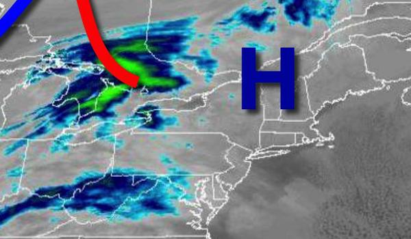
High pressure will provide excellent yet cold weather conditions today but active weather returns for the upcoming Christmas week.
High pressure will produce clear skies to scattered cloud cover today through this evening. Winds will be from the northwest at 5 to 15 mph. Temperatures will rise into the upper 20s to lower 30s for highs.
A cold front will pass through the region tomorrow with scattered clouds and isolated rain and snow showers. Winds will back to the southwest at 5 to 15 mph. Temperatures will range from the upper 10s to mid-20s for lows and lower to mid-30s over the interior and mid-30s to lower 40s along the coast for highs.
High pressure will produce scattered clouds on Monday with light and variable winds. Temperatures on Monday will range from the mid-20s to lower 30s for lows and upper 30s to lower 40s for highs.
A series of weak troughs will follow on Tuesday through Wednesday with scattered clouds and a few isolated rain and snow showers. Temperatures on Tuesday will range from the upper 20s to lower 30s for lows and mid-30s to lower 40s for highs. Temperatures on Wednesday will range from the upper 10s to the lower 20s over the interior and mid-20s to lower 30s along the coast for lows mid to upper 30s for highs.
A powerful cold front will slowly approach the region on Thursday, Christmas Eve, with increasing clouds and rain towards evening. Temperatures will range from the upper 20s to lower 30s over the interior and mid to upper 30s along the coast for lows and upper 40s to lower 50s over the interior and mid to upper 50s along the coast for highs.
The cold front will move through the region on Friday, Christmas, with heavy rainfall mixing with and changing over to snow while temperatures fall through the 50s, 40s, and 30s in the morning and into the 20s by the evening.
High pressure will produce clear skies to scattered cloud cover on Saturday. Temperatures will range from the upper 10s to the lower 20s over the interior and mid-20s to lower 30s along the coast for lows and upper 20s to mid-30s for highs.