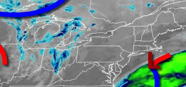
Foggy conditions this morning will give way to scattered clouds and warmer conditions by this afternoon. A powerful cold front is expected by Christmas Eve night.
A weak low-pressure system will exit this morning with areas of fog this morning giving way to scattered clouds and a few isolated showers. Winds will be from the southwest at 5 to 10 mph. Temperatures will rise into the upper 30s to lower 40s for highs.
A cold front will pass through the region tomorrow with areas of fog in the morning followed by scattered clouds and isolated showers in the afternoon. Winds will veer to the northwest at 5 to 15 mph. Temperatures tomorrow will range from the lower to mid-30s for lows and mid to upper 30s over the interior and upper 30s to mid-40s along the coast for highs.
Another cold front will follow on Wednesday with scattered clouds and isolated showers. Winds will be from the southwest at 5 to 15 mph. Temperatures on Wednesday will range from the mid-10s to lower 20s over the interior and mid-20s to lower 30s along the coast for lows and upper 30s to mid-40s for highs.
A powerful cold front will approach the region on Thursday, Christmas Eve, with increasing clouds and rain towards evening. Temperatures will range from the lower to mid-30s over the interior and upper 30s to mid-40s along the coast and mid to upper 50s for highs. High temperatures will be in the evening hours.
The cold front will move through the region on Friday, Christmas, in the morning hours with waves of heavy rain, gradually changing to snow from northwest to southeast. Some minor snow accumulation will be possible for higher elevations. Windy conditions can be expected with clearing skies in the afternoon and evening. Temperatures will fall from the 50s and 40s early in the morning into the 30s and the 20s in the
afternoon.
High pressure will be in control Saturday through Monday with clear skies to scattered cloud cover. Temperatures on Saturday will range from the lower to mid-10s over the interior and upper 10s to lower 20s along the coast for lows and mid-20s to lower 30s for highs. Temperatures on Sunday will range from the mid to upper 10s over the interior and lower to mid-20s along the coast for lows and lower to mid-30s over the interior and mid to upper
30s along the coast for highs. Temperatures on Monday will range from the mid-20s to lower 30s for lows and lower to mid-40s over the interior and mid-40s to lower 50s along the coast for highs.