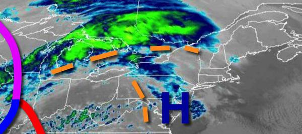
Clouds will be increasing today as high pressure exits today, which will give way to an active weather pattern for the New Year's weekend with snow, ice, and rain a threat.
High pressure will exit the region today with increasing clouds through the evening. Winds will be from the southwest at 5 to 15 mph. Temperatures will rise into the mid to upper 30s over the interior and lower to mid-40s along the coast for highs.
A cold front will follow tomorrow with scattered showers expected in the afternoon. Skies will clear in the evening in time for New Year's Eve. Winds will be from the northwest at 5 to 15 mph. Temperatures tomorrow will range from the lower to mid-30s over the interior and upper 30s to mid-40s along the coast for lows and upper 30s to lower 40s over the interior and mid to upper 40s along the coast for highs.
An area of low pressure will approach on Friday, New Year's Day with rain developing along the coast in the afternoon and a mix of snow, sleet, and freezing rain for the interior. Significant ice accumulation will be possible Friday evening in northeastern Pennsylvania. Winds will be from the east at 5 to 15 mph. Temperatures on Friday will range from the lower to mid-20s over the interior and upper 20s to lower 30s along the coast for
lows and mid to upper 30s over the interior and upper 30s to mid-40s along the coast for highs.
A cold front will follow on Saturday with showers in the morning followed by clearing skies. Temperatures on Saturday will range from the mid-30s to lower 40s for lows and mid-40s to lower 50s for highs.
Another area of low pressure will follow on Sunday with periods of rain and snow in the afternoon and evening. Temperatures on Sunday will range from the lower to mid-30s for lows and mid to upper 30s over the interior and lower to mid-40s along the coast for highs.
Rain and snow showers will exit on Monday morning followed by clearing skies. Temperatures on Monday will range from the lower to mid-30s over the interior and mid to upper 30s along the coast for lows and mid to upper 30s over the interior and lower to mid-40s along the coast for highs.
High pressure will be in control on Tuesday and Wednesday with clear skies to scattered clouds. Temperatures will range from the upper 20s to lower 30s over the interior and mid to upper 30s along the coast for lows and mid-30s over the interior and upper 30s to mid-40s along the coast for highs.