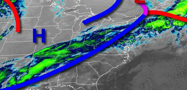
A cold front will bring showers through this afternoon, but skies will clear out just in time to bring an end to 2020 and start 2021!
A cold front will move through the region today with periods of showers, heavy at times, through this afternoon. Winds will veer from the southwest to northwest at 5 to 15 mph with gusts up to 30 mph at times. Temperatures will rise into the mid-30s to lower 40s over the interior and mid to upper 40s along the coast for highs.
High pressure will build into the region this evening through tomorrow morning with clear skies to scattered cloud cover. Winds will be from the north at 5 to 15 mph. Temperatures will fall into the lower to mid-20s over the interior and upper 20s to lower 30s along the coast for lows.
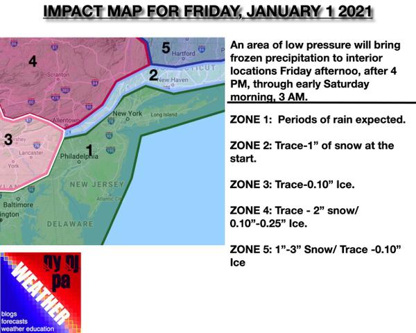
An area of low pressure will approach from the Tennessee River Valley tomorrow with rain developing for most locations tomorrow afternoon. Precipitation will start as snow, sleet, and freezing rain for interior locations tomorrow afternoon and evening before gradually changing over to rain. Some snow and ice accumulation can be expected. Please see the details below. Winds will veer from the northeast to east at 5 to 15 mph with
gusts over 20 mph at times. Temperatures will rise into the upper 30s to lower 40s for highs.