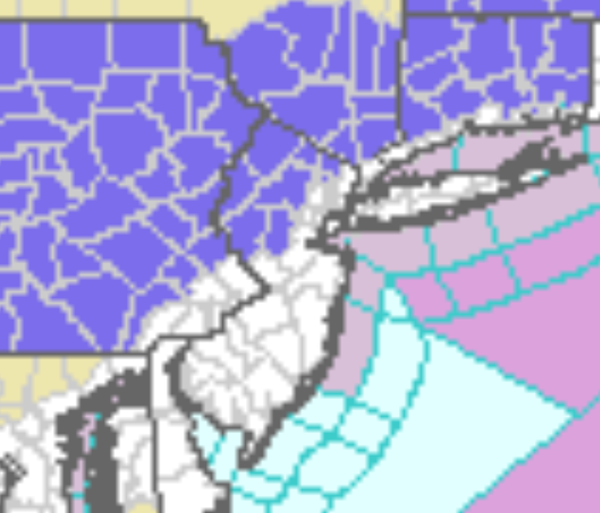
...WINTER WEATHER ADVISORY REMAINS IN EFFECT FROM 11 AM TO 11 PM
EST SUNDAY...

* WHAT...Wet snow expected. Total snow accumulations of 2 to 4
  inches. The higher terrain will see the most snowfall.

* WHERE...Pike, Bradford, Susquehanna, Wyoming, Lackawanna,
  Luzerne, Southern Wayne and Northern Wayne counties.

* WHEN...Snow will develop late in the morning Sunday, peak in
  intensity in the afternoon and taper off Sunday evening.
...WINTER WEATHER ADVISORY IN EFFECT FROM 5 AM TO NOON EST
SUNDAY...
* WHAT...Mixed precipitation expected. Total snow accumulations
of up to one inch and ice accumulations of a light glaze.
* WHERE...Dauphin, Lebanon, York and Lancaster Counties.
* WHEN...From 5 AM to noon EST Sunday.
* IMPACTS...Plan on slippery road conditions.
...WINTER WEATHER ADVISORY IN EFFECT FROM 1 PM SUNDAY TO 7 AM EST
MONDAY...

* WHAT...Mainly snow expected. Total snow accumulations of 2 to 4
  inches and ice accumulations of a light glaze possible. Locally
  higher snowfall possible across the higher terrain of central
  and western Massachusetts.

* WHERE...Portions of northern Connecticut and central, eastern,
  northeastern and western Massachusetts.

* WHEN...From 1 PM Sunday to 7 AM EST Monday.

* IMPACTS...Plan on slippery road conditions. The hazardous
  conditions could impact the morning commute.
...WINTER WEATHER ADVISORY IN EFFECT FROM 9 AM SUNDAY TO MIDNIGHT
EST SUNDAY NIGHT...

* WHAT...Snow expected. Total snow accumulations of 1 to 3 inches,
  highest in the hills and near the Interstate 287 and Route 23
  corridors.

* WHERE...Eastern Passaic and Western Bergen Counties.

* WHEN...From 9 AM Sunday to midnight EST Sunday night.

* IMPACTS...Plan on slippery road conditions.
...WINTER WEATHER ADVISORY IN EFFECT FROM 9 AM SUNDAY TO MIDNIGHT
EST SUNDAY NIGHT...

* WHAT...Snow expected. Total snow accumulations of 2 to 4
  inches.

* WHERE...Interior northeast New Jersey, southern Connecticut and
  southeast New York.

* WHEN...From 9 AM Sunday to midnight EST Sunday night.

* IMPACTS...Plan on slippery road conditions.
...WINTER WEATHER ADVISORY IN EFFECT FROM 1 PM SUNDAY TO MIDNIGHT
EST SUNDAY NIGHT...

* WHAT...Snow expected. Total snow accumulations of 3 to 5 inches.

* WHERE....Litchfield, Berkshire, Dutchess and Ulster counties.

* WHEN...From 1 PM Sunday to midnight Sunday night.

* IMPACTS...Plan on slippery road conditions.

* ADDITIONAL DETAILS...Snow will quickly overspread the advisory
  area during the early to mid afternoon hours and is expected to
  taper off by around midnight.
...WINTER WEATHER ADVISORY IN EFFECT FROM 9 AM SUNDAY TO 1 AM EST
MONDAY...

* WHAT...Mixed precipitation expected. Total snow accumulations
  of 1 to 3 inches and ice accumulations of a light glaze.

* WHERE...In New Jersey, Sussex. In Pennsylvania, Carbon and
  Monroe.

* WHEN...From 9 AM Sunday to 1 AM EST Monday.

* IMPACTS...Plan on slippery road conditions.
...WINTER WEATHER ADVISORY IN EFFECT FROM 9 AM SUNDAY TO 1 AM EST
MONDAY...

* WHAT...Mixed precipitation expected. Total snow accumulations
  of up to one inch and ice accumulations of a light glaze.

* WHERE...Portions of northern and northwest New Jersey and east
  central and southeast Pennsylvania.

* WHEN...From 9 AM Sunday to 1 AM EST Monday.

* IMPACTS...Plan on slippery road conditions.

* ADDITIONAL DETAILS...Precipitation may start as a mixture of
  freezing rain and sleet before transitioning to mostly plain
  rain into the afternoon. A brief transition to snow is possible
  Sunday night before the system exits the region.