After a cold start to the week, a slow and steady warm-up is expected before a strong cold front crashes through on Saturday.
A series of troughs will move through the region today with scattered clouds and a few flurries possible. Winds will be from the southwest at 5 to 15 mph. Temperatures will rise into the mid-30s over the interior and upper 30s to lower 40s along the coast.
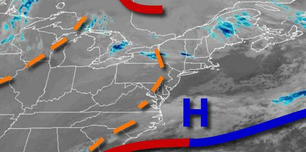
High pressure will be in control tonight through Thursday with scattered clouds expected. Winds will be from the southwest at 5 to 15 mph. Temperatures tomorrow will range from the mid to upper 20s for lows and upper 30s to lower 40s for highs. Temperatures on Thursday will range from the upper 20s to lower 30s for lows and lower to mid-40s for highs.
High pressure will exit on Friday as a cold front approaches from the west with increasing clouds and showers towards midnight. Temperatures on Friday will range from the upper 20s to lower 30s for lows and lower to mid-40s over the interior and upper 40s to lower 50s along the coast for highs.
An area of low pressure and the cold front will move through the region on Saturday with rain for most of the region and a mix over from rain to snow in the Poconos and Catskills. No significant snow accumulation is expected. Temperatures will range from the lower to mid-30s over the interior and upper 30s to lower 40s along the coast for lows and upper 30s over the interior and lower to mid-40s along the coast for highs.
High pressure will be in control Sunday through Tuesday with clear skies to scattered clouds. Temperatures will range from the lower to mid-20s over the interior and upper 20s to lower 30s along the coast for lows and lower to mid-30s over the interior and upper 30s to lower 40s along the coast for highs.