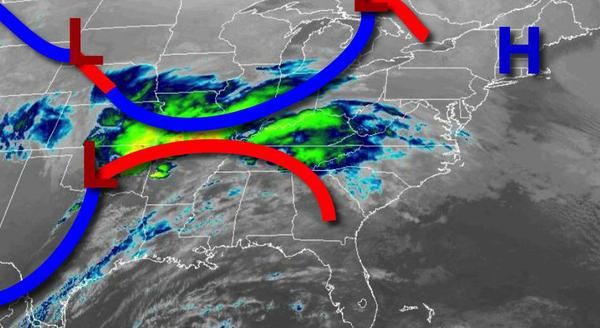
An area of low pressure will bring waves of light snow, sleet, and rain to the region to start the week. Another storm threat is possible by the end of next weekend.
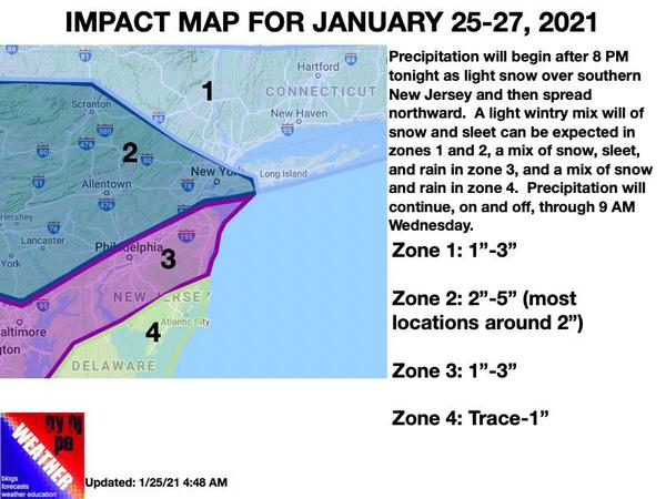
Clouds will be on the increase today as an area of low pressure approaches from the southwest. Snow showers will develop by this evening, especially over southern New Jersey. Winds will veer from the northwest to north at 5 to 15 mph. Temperatures will rise into the mid to upper 30s for highs.
A light wintry mix of snow, sleet, and rain will linger over the region tonight through Tuesday as an area of low pressure passes to the south. At times, the precipitation will taper off to just a few flurries. Winds will veer to the northeast at 5 to 15 mph. Temperatures on Tuesday will range from the mid to upper 20s for lows and lower to mid-30s over the interior and I-95 Corridor and mid-30s to lower 40s in southern New
Jersey.
The low-pressure system will depart on Wednesday morning with a period of light snow in the early morning hours followed by clearing skies. Winds will back to the north at 5 to 15 mph. Temperatures on Wednesday will range from the upper 20s to lower 30s for lows and upper 20s to lower 30s over the interior and mid to upper 30s along the coast for highs.