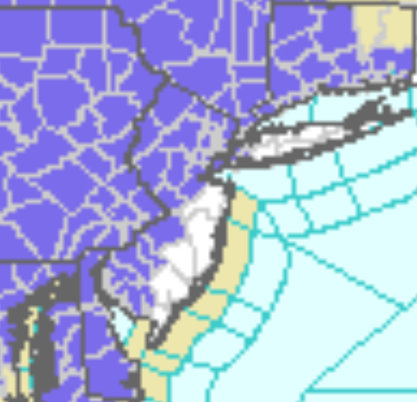
Winter Weather Advisories For Most Of The Region For Tomorrow
|
...WINTER WEATHER ADVISORY IN EFFECT FROM 7 AM TUESDAY TO
MIDNIGHT EST TUESDAY NIGHT...
* WHAT...Mixed precipitation expected. Total snow accumulations
of up to one inch and ice accumulations of a light glaze.
* WHERE...Southern Queens County.
* WHEN...From 7 AM Tuesday to midnight EST Tuesday night.
* IMPACTS...Plan on slippery road conditions. The hazardous
conditions could impact the evening commute. ...WINTER WEATHER ADVISORY REMAINS IN EFFECT FROM 7 AM TUESDAY TO
MIDNIGHT EST TUESDAY NIGHT...
* WHAT...Mixed precipitation expected. Total snow accumulations
of up to one inch and ice accumulations of a light glaze.
* WHERE...Portions of northeast New Jersey and southeast New
York.
* WHEN...From 7 AM Tuesday to midnight EST Tuesday night.
* IMPACTS...Plan on slippery road conditions. The hazardous
conditions could impact the evening commute. ...WINTER WEATHER ADVISORY REMAINS IN EFFECT FROM 7 AM TUESDAY TO
6 AM EST WEDNESDAY...
* WHAT...Mixed precipitation expected. Total snow accumulations
of up to two inches and ice accumulations of a light glaze.
* WHERE...Portions of northeast New Jersey and southeast New
York.
* WHEN...From 7 AM Tuesday to 6 AM EST Wednesday.
* IMPACTS...Plan on slippery road conditions. The hazardous
conditions could impact the evening commute.
...WINTER WEATHER ADVISORY REMAINS IN EFFECT FROM 7 AM TUESDAY TO
6 AM EST WEDNESDAY...
* WHAT...Mixed precipitation expected. Total snow accumulations
of up to two inches and ice accumulations of a light glaze.
* WHERE...Portions of southern Connecticut.
* WHEN...From 7 AM Tuesday to 6 AM EST Wednesday.
* IMPACTS...Plan on slippery road conditions. The hazardous
conditions could impact the evening commute.
* ADDITIONAL DETAILS...The highest snowfall amounts will be away
from the coast.
...WINTER WEATHER ADVISORY IN EFFECT FROM NOON TUESDAY TO 10 AM
EST WEDNESDAY...

* WHAT...Snow expected. Total snow accumulations of 1 to 4
  inches.

* WHERE...Northwestern Connecticut and the mid Hudson Valley and
  southern Taconics of eastern New York.

* WHEN...From noon Tuesday to 10 AM EST Wednesday.

* IMPACTS...Plan on slippery road conditions and reduced
  visibilities. The hazardous conditions will likely impact the
  Tuesday evening, and Wednesday morning commutes.

* ADDITIONAL DETAILS...Some sleet or freezing rain could mix in at
  times Tuesday evening, especially close to Interstate 84.
...WINTER WEATHER ADVISORY IN EFFECT FROM 10 AM TUESDAY TO 10 AM
EST WEDNESDAY...

* WHAT...Snow expected. Total snow accumulations of 3 to 6
  inches.

* WHERE...Schoharie County, the Helderbergs and eastern Catskills
  of eastern New York.

* WHEN...From 10 AM Tuesday to 10 AM EST Wednesday.

* IMPACTS...Plan on slippery road conditions and reduced
  visibilities. The hazardous conditions will likely impact the
  Tuesday evening, and Wednesday morning commutes.

* ADDITIONAL DETAILS...Snowfall rates could briefly reach one inch
  per hour Tuesday afternoon.
...WINTER WEATHER ADVISORY IN EFFECT FROM 9 AM TUESDAY TO 1 AM
EST WEDNESDAY...

* WHAT...Snow and mixed precipitation expected.

* WHERE...In Pennsylvania, Susquehanna, Northern Wayne,
  Lackawanna, Pike and Southern Wayne counties. In New York,
  Seneca, Tompkins, Tioga and Broome counties.

* WHEN...From 9 AM Tuesday to 1 AM EST Wednesday.

* IMPACTS...Plan on slippery road conditions. The hazardous
  conditions could impact the evening commute.

* ADDITIONAL DETAILS...A band of steady light snow will lift
  across the region Tuesday morning, and will stall out along or
  just north of the New York State Thruway in the early afternoon.
  Further to south, snow will mix with or change to freezing rain
  or freezing drizzle, with precipitation becoming spotty in
  coverage. Total snow accumulations of 1 to 3 inches will be
  common, with 3 to 5 inches north of the Thruway. Ice
  accumulations will generally be around one tenth of an inch,
  with localized areas of up to a quarter of an inch.
...WINTER WEATHER ADVISORY IN EFFECT FROM 1 AM TO 1 PM EST
TUESDAY...

* WHAT...Mixed precipitation expected. Total snow and sleet
  accumulations of up to one inch and ice accumulations up to one
  tenth of an inch.

* WHERE...Portions of central and northern New Jersey and
  southeast Pennsylvania.

* WHEN...From 1 AM to 1 PM EST Tuesday.

* IMPACTS...Plan on slippery road conditions. The hazardous
  conditions could impact the morning commute.

* ADDITIONAL DETAILS...A light wintry mix will develop overnight
  then change to rain by Tuesday afternoon as temperatures warm
  above freezing.
...WINTER WEATHER ADVISORY IN EFFECT FROM 1 AM TUESDAY TO 4 AM
EST WEDNESDAY...

* WHAT...Mixed precipitation expected. Total snow and sleet
  accumulations of up to one inch and ice accumulations of one
  tenth to two tenths of an inch.

* WHERE...Portions of northern and northwest New Jersey and east
  central, northeast and southeast Pennsylvania.

* WHEN...From 1 AM Tuesday to 4 AM EST Wednesday.

* IMPACTS...Plan on slippery road conditions. The hazardous
  conditions could impact the morning or evening commute.

* ADDITIONAL DETAILS...A light wintry mix will develop overnight
  then change to light freezing rain and freezing drizzle
  continuing through Tuesday.
...WINTER WEATHER ADVISORY IN EFFECT FROM 7 AM TUESDAY TO 4 AM
EST WEDNESDAY...

* WHAT...Mixed precipitation expected. Total snow and sleet
  accumulations around one inch and ice accumulations of one
  tenth to two tenths of an inch.

* WHERE...In New Jersey, Sussex, Warren and Morris. In
  Pennsylvania, Monroe.

* WHEN...From 7 AM Tuesday to 4 AM EST Wednesday.

* IMPACTS...Plan on slippery road conditions. The hazardous
  conditions could impact the morning or evening commute.

* ADDITIONAL DETAILS...A light wintry mix will develop Tuesday
  morning then change to light freezing rain and freezing drizzle
  Tuesday evening. Freezing rain and freezing drizzle will
  diminish early Wednesday morning.
...WINTER WEATHER ADVISORY IN EFFECT FROM 1 PM TUESDAY TO 10 AM
EST WEDNESDAY...

* WHAT...Snow expected. Total snow accumulations averaging 2 to 3
  inches.

* WHERE...In Connecticut, Hartford CT County. In Massachusetts,
  Western Franklin MA, Western Hampshire MA and Western Hampden
  MA Counties.

* WHEN...From 1 PM Tuesday to 10 AM EST Wednesday.

* IMPACTS...Plan on slippery road conditions. The hazardous
  conditions could impact the morning or evening commute.
SUBSCRIBE TO PREMIUM CONSULTING MEMBERSHIP FOR MORE INFORMATION
|
|