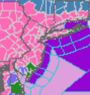
Updated Winter Storm Watches, Warnings, and Advisories
|
...WINTER STORM WARNING REMAINS IN EFFECT FROM 5 PM THIS
AFTERNOON TO 1 PM EST TUESDAY...

* WHAT...Heavy snow expected. Total snow accumulations of 13 to
  18 inches. Winds gusting as high as 35 mph.

* WHERE...Portions of central, northern and northwest New Jersey
  and southeast Pennsylvania.

* WHEN...From 5 PM this afternoon to 1 PM EST Tuesday.

* IMPACTS...Travel could be very difficult to impossible. The
  hazardous conditions could impact the morning or evening
  commute.

* ADDITIONAL DETAILS...Snow develops late this afternoon and will
  last through Monday night or early Tuesday. Snow may be heavy
  at times on Monday.
...WINTER STORM WARNING REMAINS IN EFFECT FROM 5 PM THIS
AFTERNOON TO 1 PM EST TUESDAY...

* WHAT...Heavy snow expected. Total snow accumulations of 15 to
  19 inches.

* WHERE...Portions of northern New Jersey and east central and
  northeast Pennsylvania.

* WHEN...From 5 PM this afternoon to 1 PM EST Tuesday.

* IMPACTS...Travel could be very difficult to impossible. The
  hazardous conditions could impact the morning or evening
  commute.

* ADDITIONAL DETAILS...Snow develops late this afternoon and will
  last through Monday night or early Tuesday. Snow may be heavy at
  times on Monday.
...WINTER STORM WARNING NOW IN EFFECT FROM 1 PM THIS AFTERNOON TO
10 AM EST TUESDAY...

* WHAT...Heavy mixed precipitation expected. Total snow
  accumulations of 8 to 12 inches and ice accumulations of
  around one tenth of an inch. Winds gusting as high as 35 mph.

* WHERE...In New Jersey, Gloucester, Salem and Camden. In
  Delaware, New Castle.

* WHEN...From 1 PM this afternoon to 10 AM EST Tuesday.

* IMPACTS...Travel could be very difficult to impossible. The
  hazardous conditions could impact the morning or evening
  commute.

* ADDITIONAL DETAILS...Snow develops late this morning and will
  last through Monday night or early Tuesday. A period of mixed
  precipitation, or rain, may develop late tonight through Monday
  morning. This may cut down on snow totals, and will change back
  to snow Monday afternoon.
...WINTER STORM WARNING REMAINS IN EFFECT FROM 1 PM THIS
AFTERNOON TO 10 AM EST TUESDAY...

* WHAT...Heavy snow expected. Total snow accumulations of 6 to 8
  inches. Winds gusting as high as 45 mph.

* WHERE...Ocean and Southeastern Burlington.

* WHEN...From 1 PM this afternoon to 10 AM EST Tuesday.

* IMPACTS...Travel could be very difficult to impossible. The
  hazardous conditions could impact the morning or evening
  commute. Gusty winds could bring down tree branches.

* ADDITIONAL DETAILS...Snow develops this afternoon and will last
  through Monday night or early Tuesday. Snow may mix with and
  change to rain for a period late tonight through Monday
  afternoon, and may cut down on snow totals. Any mixed
  precipitation will change back to snow Monday evening.
...WINTER STORM WARNING NOW IN EFFECT FROM 5 PM THIS AFTERNOON TO
1 PM EST TUESDAY...

* WHAT...Heavy snow expected. Total snow accumulations of 13 to
  17 inches.

* WHERE...Berks.

* WHEN...From 5 PM this afternoon to 1 PM EST Tuesday.

* IMPACTS...Travel could be very difficult to impossible. The
  hazardous conditions could impact the morning or evening
  commute.

* ADDITIONAL DETAILS...Snow develops late this afternoon and will
  last through Monday night or early Tuesday. Snow may be heavy at
  times on Monday.
...WINTER STORM WARNING REMAINS IN EFFECT FROM 1 PM THIS
AFTERNOON TO 10 AM EST TUESDAY...

* WHAT...Heavy snow expected. Total snow accumulations of 7 to
  14 inches. Winds gusting as high as 45 mph.

* WHERE...In Pennsylvania, Philadelphia. In New Jersey, Eastern
  Monmouth, Western Monmouth and Northwestern Burlington.

* WHEN...From 1 PM this afternoon to 10 AM EST Tuesday.

* IMPACTS...Travel could be very difficult to impossible. The
  hazardous conditions could impact the morning or evening
  commute.

* ADDITIONAL DETAILS...Snow develops late this afternoon and will
  last through Monday night or early Tuesday. A brief period of
  mixed precipitation is possible late tonight through Monday
  morning, and may cut down on snow totals. Any mixed
  precipitation will change back to snow Monday afternoon.
...WINTER STORM WARNING IN EFFECT UNTIL 5 AM EST TUESDAY...

* WHAT...Heavy snow expected. Total snow accumulations of 8 to 14
  inches, with the highest amounts north and east of Harrisburg. A
  light glaze of ice is also likely from Harrisburg southward.

* WHERE...Portions of central Pennsylvania.

* WHEN...Light snow will overspread the region this morning and
  continue through tonight. The snow could become heavier on
  Monday and potentially mix with ice from Harrisburg southward.
  Expect the snow to taper off by late Monday night.

* IMPACTS...Travel could be difficult today through Monday
  evening.
...WINTER STORM WARNING REMAINS IN EFFECT FROM 5 PM THIS
AFTERNOON TO 1 PM EST TUESDAY...

* WHAT...Heavy snow expected. Total snow accumulations of 9 to
  15 inches with locally higher amounts.

* WHERE...Wyoming and Luzerne counties.

* WHEN...From 5 PM Sunday to 1 PM EST Tuesday.

* IMPACTS...Travel could be very difficult to impossible. The
  hazardous conditions are expected to impact the morning and
  evening commutes Monday.

* ADDITIONAL DETAILS...This will be a long duration event.
  Several inches of lighter snow are expected Sunday evening
  through Monday morning. Then for Monday afternoon through
  Monday night, additional snow is expected which will be heavy
  at times, with snowfall rates occasionally in excess of an
  inch per hour. Snow will linger into Tuesday with areas of
  blowing snow.
...WINTER STORM WARNING IN EFFECT FROM 7 PM THIS EVENING TO 6 AM
EST TUESDAY...

* WHAT...Heavy snow expected. Total snow accumulations of 14 to
  18 inches. Winds gusting as high as 35 mph.

* WHERE...Western Passaic, Eastern Passaic, Western Bergen,
  Western Essex and Western Union Counties.

* WHEN...From 7 PM this evening to 6 AM EST Tuesday.

* IMPACTS...Travel could be very difficult to impossible. The
  hazardous conditions could impact the morning and evening
  commute.
...WINTER STORM WARNING IN EFFECT FROM 7 PM THIS EVENING TO 6 AM
EST TUESDAY...

* WHAT...Heavy snow expected. Total snow accumulations of 14 to
  18 inches. Winds gusting as high as 45 mph.

* WHERE...Portions of northeast New Jersey and southeast New
  York.

* WHEN...From 7 PM this evening to 6 AM EST Tuesday.

* IMPACTS...Travel could be very difficult to impossible. The
  hazardous conditions could impact the morning and evening
  commute. Gusty winds could bring down tree branches.

* ADDITIONAL DETAILS...Blizzard like conditions possible Monday
  and Monday evening.
...WINTER STORM WARNING IN EFFECT FROM MIDNIGHT TONIGHT TO 6 AM
EST TUESDAY...

* WHAT...Heavy snow expected. Total snow accumulations of 11 to
  16 inches. Winds gusting as high as 50 mph.

* WHERE...Northern Fairfield, Northern New Haven, Southern
  Fairfield and Southern New Haven Counties.

* WHEN...From midnight tonight to 6 AM EST Tuesday.

* IMPACTS...Travel could be very difficult to impossible. The
  hazardous conditions could impact the morning and evening
  commute. Gusty winds could bring down tree branches.

* ADDITIONAL DETAILS...Blizzard like conditions possible Monday
  and Monday evening, especially near the coast
..WINTER STORM WARNING IN EFFECT FROM MIDNIGHT TONIGHT TO 6 AM
EST TUESDAY...

* WHAT...Heavy snow expected. Total snow accumulations of 14 to
  18 inches. Winds gusting as high as 35 mph.

* WHERE...Orange, Putnam, Rockland and Northern Westchester
  Counties.

* WHEN...From midnight tonight to 6 AM EST Tuesday.

* IMPACTS...Travel could be very difficult to impossible. The
  hazardous conditions could impact the morning and evening
  commute.
...WINTER STORM WARNING IN EFFECT FROM MIDNIGHT TONIGHT TO 6 AM
EST TUESDAY...

* WHAT...Heavy snow expected. Total snow accumulations of 6 to
  16 inches. Winds gusting as high as 50 mph.

* WHERE...Northwestern Suffolk, Southwestern Suffolk, Northern
  Nassau and Southern Nassau Counties.

* WHEN...From midnight tonight to 6 AM EST Tuesday.

* IMPACTS...Travel could be very difficult to impossible. The
  hazardous conditions could impact the morning and evening
  commute. Gusty winds could bring down tree branches.

* ADDITIONAL DETAILS...Blizzard like conditions possible Monday
  and Monday evening. Some mixing of sleet and rain could limit
  snowfall amounts, especially along the south shore.
...WINTER STORM WARNING IN EFFECT FROM MIDNIGHT TONIGHT TO 6 AM
EST TUESDAY...

* WHAT...Heavy snow expected. Total snow accumulations of 7 to
  13 inches. Winds gusting as high as 45 mph.

* WHERE...Northern Middlesex, Northern New London, Southern
  Middlesex and Southern New London Counties.

* WHEN...From midnight tonight to 6 AM EST Tuesday.

* IMPACTS...Travel could be very difficult to impossible. The
  hazardous conditions could impact the morning and evening
  commute. Gusty winds could bring down tree branches.

* ADDITIONAL DETAILS....Blizzard like conditions possible Monday
  and Monday evening, especially near the coast.
Winter Weather Advisories
...WINTER WEATHER ADVISORY REMAINS IN EFFECT FROM 10 AM THIS
MORNING TO 10 AM EST TUESDAY...

* WHAT...Snow expected. Total snow accumulations of 2 to 4
  inches. Winds gusting as high as 55 mph.

* WHERE...Coastal Ocean, Coastal Atlantic, Cape May, Cumberland
  and Atlantic.

* WHEN...From 10 AM this morning to 10 AM EST Tuesday.

* IMPACTS...Plan on slippery road conditions. The hazardous
  conditions could impact the morning or evening commute. Gusty
  winds could bring down tree branches.

* ADDITIONAL DETAILS...Snow will develop this morning and will
  last through late Monday or early Tuesday. A period of mixed
  precipitation, or rain, which may significantly cut down on snow
  totals, will occur Sunday night and Monday morning before
  turning back to snow by Monday afternoon.
...COASTAL FLOOD WARNING IN EFFECT FROM 7 AM MONDAY TO 5 PM EST
TUESDAY...

* WHAT...One to two feet of inundation above ground level
  expected in low-lying areas near shorelines and tidal
  waterways.

* WHERE...Middlesex, Western Monmouth, Eastern Monmouth, Ocean,
  Coastal Ocean and Southeastern Burlington.

* WHEN...From 7 AM Monday to 5 PM EST Tuesday.

* IMPACTS...At this level, widespread roadway flooding occurs in
  coastal and bayside communities and along inland tidal
  waterways. Many roads become impassable. Some damage to
  vulnerable structures may begin to occur.
...COASTAL FLOOD WARNING IN EFFECT FROM 7 AM MONDAY TO 5 PM EST
TUESDAY...

* WHAT...One to two feet of inundation above ground level
  expected in low-lying areas near shorelines and tidal
  waterways.

* WHERE...In New Jersey, Atlantic, Cape May, Atlantic Coastal
  Cape May and Coastal Atlantic. In Delaware, Inland Sussex and
  Delaware Beaches.

* WHEN...From 7 AM Monday to 5 PM EST Tuesday.

* IMPACTS...At this level, widespread roadway flooding occurs in
  coastal and bayside communities and along inland tidal
  waterways. Many roads become impassable. Some damage to
  vulnerable structures may begin to occur.
...COASTAL FLOOD WARNING IN EFFECT FROM 9 AM TO 3 PM EST MONDAY...
...COASTAL FLOOD WARNING IN EFFECT FROM 8 PM MONDAY TO 3 AM EST
TUESDAY...

* WHAT...For the first Coastal Flood Warning, two to two and a
  half feet of inundation above ground level expected in
  vulnerable areas near the waterfront and shoreline. For the
  second Coastal Flood Warning, two and a half feet to three feet
  of inundation above ground level expected in vulnerable areas
  near the waterfront and shoreline.

* WHERE...Southern Nassau County.

* WHEN...For the first Coastal Flood Warning, from 9 AM to 3 PM
  EST Monday. For the second Coastal Flood Warning, from 8 PM
  Monday to 3 AM EST Tuesday.

* COASTAL FLOOD IMPACTS...Widespread MODERATE to locally MAJOR
  FLOODING of vulnerable areas near the waterfront and shoreline.
  Expect 2 to 3 feet of inundation above ground level in low
  lying, vulnerable areas, particularly Monday night. This will
  result in numerous road closures and cause widespread flooding
  of low lying property including parking lots, parks, lawns and
  homes/businesses with basements near the waterfront. Vehicles
  parked in vulnerable areas near the waterfront will likely
  become flooded.

* SHORELINE IMPACTS...Large breaking waves of 5 to 10 ft for
  multiple tidal cycles will result in significant beach erosion
  and flooding, with areas of dune erosion likely. Localized
  washovers are possible resulting in some flooding of roadways
  and vulnerable structures behind protective dunes.

* ADDITIONAL DETAILS...Moderate coastal flooding likely with the
  Tuesday morning high tide, and minor to locally moderate
  possible with Tuesday night high tide.
...COASTAL FLOOD ADVISORY IN EFFECT FROM 9 AM TO 4 PM EST
MONDAY...
...COASTAL FLOOD WARNING IN EFFECT FROM 8 PM MONDAY TO 5 AM EST
TUESDAY...

* WHAT...For the Coastal Flood Warning, around two feet of
  inundation above ground level expected in vulnerable areas near
  the waterfront and shoreline. For the Coastal Flood Advisory, up
  to one foot of inundation above ground level expected in
  vulnerable areas near the waterfront and shoreline.

* WHERE...Northwestern Suffolk and Northern Nassau Counties.

* WHEN...For the Coastal Flood Warning, from 8 PM Monday to 5 AM
  EST Tuesday. For the Coastal Flood Advisory, from 9 AM to 4 PM
  EST Monday.

* COASTAL FLOOD IMPACTS...Widespread minor to moderate flooding
  of vulnerable areas near the waterfront and shoreline is likely
  Monday night. Around 2 feet of inundation above ground level in
  low lying, vulnerable areas Monday Night. This will result in
  numerous road closures and cause widespread flooding of low
  lying property including parking lots, parks, lawns and
  homes/businesses with basements near the waterfront. Vehicles
  parked in vulnerable areas near the waterfront will likely
  become flooded.

* SHORELINE IMPACTS...3 to 6 ft breaking waves will likely cause
  localized beach erosion, wave splash over seawalls and
  bulkheads, and possible minor damage to shoreline structures during
  the time of high tide Monday Night.
..COASTAL FLOOD WARNING IN EFFECT FROM 9 AM TO 3 PM EST MONDAY...
...COASTAL FLOOD WARNING IN EFFECT FROM 8 PM MONDAY TO 3 AM EST
TUESDAY...

* WHAT...For the first Coastal Flood Warning, around two feet of
  inundation above ground level expected in vulnerable areas near
  the waterfront and shoreline. For the second Coastal Flood
  Warning, two to two and a half feet of inundation above ground
  level expected in vulnerable areas near the waterfront and
  shoreline.

* WHERE...Southern Queens County.

* WHEN...For the first Coastal Flood Warning, from 9 AM to 3 PM
  EST Monday. For the second Coastal Flood Warning, from 8 PM
  Monday to 3 AM EST Tuesday.

* COASTAL FLOOD IMPACTS...Widespread moderate flooding of
  vulnerable areas near the waterfront and shoreline. Expect 2 to
  2 1/2 feet of inundation above ground level in low lying,
  vulnerable areas, particularly Monday night. This will result in
  numerous road closures and cause widespread flooding of low
  lying property including parking lots, parks, lawns and
  homes/businesses with basements near the waterfront. Vehicles
  parked in vulnerable areas near the waterfront will likely
  become flooded.

* SHORELINE IMPACTS...Along the oceanfront, breaking waves will
  result in beach erosion and flooding with minor dune erosion
  possible.

* ADDITIONAL DETAILS...Minor to locally moderate coastal flooding
  likely during the tides of high tide on Tuesday.
...COASTAL FLOOD ADVISORY IN EFFECT FROM 9 AM TO 5 PM EST
MONDAY...
...COASTAL FLOOD WARNING IN EFFECT FROM 8 PM MONDAY TO 5 AM EST
TUESDAY...

* WHAT...For the Coastal Flood Warning, two to three feet of
  inundation above ground level expected in vulnerable areas near
  the waterfront and shoreline. For the Coastal Flood Advisory,
  around one foot of inundation above ground level expected in
  vulnerable areas near the waterfront and shoreline.

* WHERE...Northeastern Suffolk and Southeastern Suffolk Counties.

* WHEN...For the Coastal Flood Warning, from 8 PM Monday to 5 AM
  EST Tuesday. For the Coastal Flood Advisory, from 9 AM to 5 PM
  EST Monday.

* COASTAL FLOOD IMPACTS...Widespread MODERATE to locally MAJOR
  FLOODING of vulnerable areas near the waterfront and shoreline
  Monday Night. Expect 2 to 3 feet of inundation above ground
  level in low lying, vulnerable areas, Monday night. This will
  result in numerous road closures and cause widespread flooding
  of low lying property including parking lots, parks, lawns and
  homes/businesses with basements near the waterfront. Vehicles
  parked in vulnerable areas near the waterfront will likely
  become flooded.

* SHORELINE IMPACTS...Along the oceanfront, large breaking waves
  of 5 to 10 ft for multiple tidal cycles will result in
  significant beach erosion and flooding, with areas of dune
  erosion likely. Localized washovers are possible resulting in
  some flooding of roadways and vulnerable structures behind
  protective dunes. Along the Long Island Sound shorefront and the
  twin forks, 4 to 6 ft breaking waves will likely cause
  localized beach erosion, wave splash over seawalls and
  bulkheads, and possible minor damage to shoreline structures,
  particularly during the time of high tide Monday Night.
...COASTAL FLOOD ADVISORY IN EFFECT FROM 9 AM TO 5 PM EST
MONDAY...
...COASTAL FLOOD WARNING IN EFFECT FROM 8 PM MONDAY TO 3 AM EST
TUESDAY...

* WHAT...For the Coastal Flood Warning, two to three foot of
  inundation above ground level expected in vulnerable areas near
  the waterfront and shoreline. For the Coastal Flood Advisory, up
  to one foot of inundation above ground level expected in
  vulnerable areas near the waterfront and shoreline.

* WHERE...Southwestern Suffolk County.

* WHEN...For the Coastal Flood Warning, from 8 PM Monday to 3 AM
  EST Tuesday. For the Coastal Flood Advisory, from 9 AM to 5 PM
  EST Monday.

* COASTAL FLOOD IMPACTS...Widespread MODERATE to locally MAJOR
  FLOODING of vulnerable areas near the waterfront and shoreline
  Monday Night. Expect 2 to 3 feet of inundation above ground
  level in low lying, vulnerable areas, Monday night. This will
  result in numerous road closures and cause widespread flooding
  of low lying property including parking lots, parks, lawns and
  homes/businesses with basements near the waterfront. Vehicles
  parked in vulnerable areas near the waterfront will likely
  become flooded.

* SHORELINE IMPACTS...Along the oceanfront, large breaking waves
  of 5 to 10 ft for multiple tidal cycles will result in
  significant beach erosion and flooding, with areas of dune
  erosion likely. Localized washovers are possible resulting in
  some flooding of roadways and vulnerable structures behind
  protective dunes.

* ADDITIONAL DETAILS...Moderate coastal flooding likely with the
  Tuesday morning high tide, and minor to locally moderate
  possible with Tuesday night high tide.
..WINTER STORM WATCH REMAINS IN EFFECT FROM LATE TONIGHT THROUGH
LATE MONDAY NIGHT...

* WHAT...Heavy snow possible. Total snow accumulations of 3 to
  11 inches possible. Winds could gust as high as 60 mph.

* WHERE...Southeastern Suffolk and Northeastern Suffolk Counties.

* WHEN...From late tonight through late Monday night.

* IMPACTS...Travel could be very difficult. The hazardous
  conditions could impact the morning and evening commute. Strong
  winds could cause tree damage.
...WINTER STORM WATCH REMAINS IN EFFECT FROM MONDAY MORNING
THROUGH TUESDAY AFTERNOON...

* WHAT...Heavy snow. Total snow accumulations of 8 to 15 inches
  possible.

* WHERE...The eastern Catskills, mid-Hudson Valley and southern
  and central Taconics.

* WHEN...From Monday morning through Tuesday afternoon.

* IMPACTS...Travel could be very difficult. The hazardous
  conditions could impact the morning or evening commute.
...WINTER STORM WATCH REMAINS IN EFFECT FROM MONDAY MORNING
THROUGH TUESDAY AFTERNOON...

* WHAT...Heavy snow. Total snow accumulations of 12 to 18 inches
  possible. Winds could gust as high as 35 mph.

* WHERE...In Connecticut, Litchfield County. In Massachusetts,
  Berkshire County.

* WHEN...From Monday morning through Tuesday afternoon.

* IMPACTS...Travel could be very difficult. The hazardous
  conditions could impact the morning or evening commute.
...WINTER STORM WATCH NOW IN EFFECT FROM MONDAY MORNING THROUGH
TUESDAY AFTERNOON...

* WHAT...Heavy snow possible. Total snow accumulations of 6 to
  14 inches possible. Winds could gust as high as 35 mph.

* WHERE...Portions of northern Connecticut, central, eastern,
  northeastern, southeastern and western Massachusetts and
  northern and southern Rhode Island. This also includes the
  cities of Boston, Providence, Hartford and Worcester.

* WHEN...From Monday morning through Tuesday afternoon.

* IMPACTS...Travel could be very difficult. The hazardous
  conditions will likely impact the evening commute Monday.
...WINTER STORM WATCH NOW IN EFFECT FROM MONDAY MORNING THROUGH
TUESDAY AFTERNOON...

* WHAT...Heavy snow possible. Total snow accumulations of 6 to
  12 inches possible. Winds could gust as high as 35 mph.

* WHERE...Portions of northern Connecticut, central, eastern,
  northeastern, southeastern and western Massachusetts and
  northern and southern Rhode Island. This also includes the
  cities of Boston, Providence, Hartford and Worcester.

* WHEN...From Monday morning through Tuesday afternoon.

* IMPACTS...Travel could be very difficult. The hazardous
  conditions will likely impact the evening commute Monday.
SUBSCRIBE TO PREMIUM CONSULTING MEMBERSHIP FOR MORE INFORMATION
|
|