After what looked like a miss for this upcoming weekend, strong support for another significant snowfall for the region is now likely based on the latest data.
Here are the latest details on what to expect.
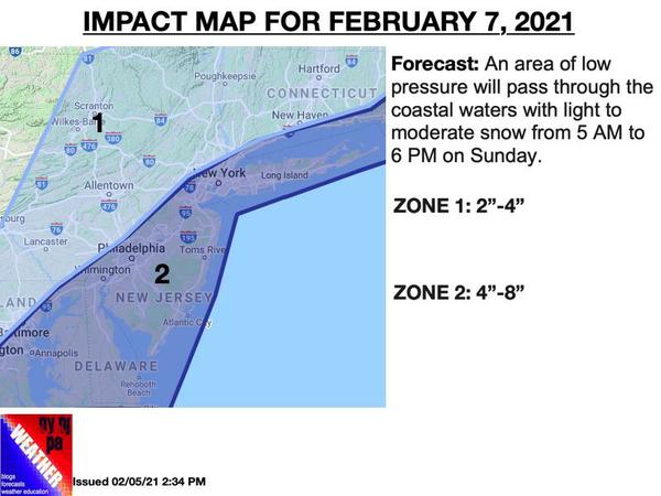
Snow will develop on Sunday morning from south to north between 4 AM to 7 AM. With temperatures in the mid-10s to lower 20s, snow accumulation will be immediate at the onset. The snow will be heavy at times on Sunday morning with the heaviest snowfall along the coast, basically in zone 2. There will be the potential for some brief convective banding which may push snowfall totals over 8" in a few isolated spots. More details on this
potential will be reevaluated tomorrow morning.
The snow will exit the region from southwest to northeast from 11 AM to 6 PM.