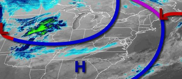
While the last winter storm was a slow slog over days, tomorrow's winter storm will come in like a freight train and exit just as quickly, but not without some significant snow impacts.
High pressure will build into the region with clear skies to scattered cloud cover. Winds will be from the northwest at 5 to 15 mph with gusts over 20 mph at times. Temperatures will rise into the upper 20s to lower 30s over the interior and mid-30s to lower 40s along the coast for highs.
An area of low pressure will approach tonight with increasing clouds and snow towards morning. Winds will veer from the northwest to northeast at 5 to 15 mph. Temperatures will fall into the mid to upper 10s over the interior, lower to mid-20s in the I-95 corridor, and upper 20s to mid-30s in southern New Jersey.
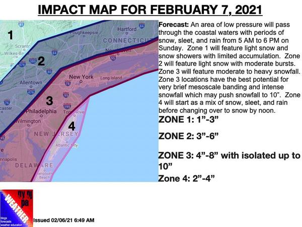
The area of low pressure will pass through the coastal waters tomorrow with snow, mixing with sleet and rain at times over southern coastal New Jersey, starting from 4 AM to 7 AM and ending from 2 PM to 7 PM from southwest to northeast. The snow will be heavy at times with locations, especially in zone 3 of the forecast map below, exceeding 1" per hour. Winds will veer to the northeast at 5 to 15 mph. Temperatures tomorrow will rise into
the upper 20s to mid-30s for highs.