Arctic cold air has produced icy, slick, and dangerous conditions this morning. An active weather pattern will be in place through this weekend with multiple threats for snowfall.
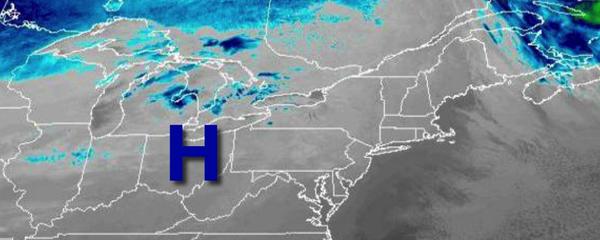
High pressure will pass through the region today with clear skies to a few clouds. Winds will be from the northwest at 5 to 15 mph. Temperatures will rise into the upper 10s to the lower 20s over the interior and mid to upper 20s along the coast for highs.
An area of low pressure will approach the region with increasing clouds tonight through tomorrow morning. Winds will veer to the north at 5 to 15 mph. Temperatures will fall into the mid to upper 10s for lows.
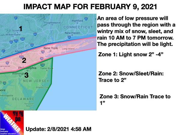
An area of low pressure will pass through the region tomorrow with periods of light snow over the interior, a wintry mix north of Philadelphia through the New York City metropolitan areas, and a mix of rain and snow in the Philadelphia metropolitan area through central and southern New Jersey. Winds will be from the northeast at 5 to 15 mph. Temperatures will rise into the upper 20s to lower 30s over the interior, mid-30s in the I-95 corridor,
and mid to upper 30s over southern New Jersey.