High pressure will be in control tonight through tomorrow with clear skies to scattered cloud cover. Winds will veer from the northwest to northeast at 5 to 15 mph. Temperatures tomorrow will range from the single digits to mid-10s for lows and mid-20s to lower 30s for highs.
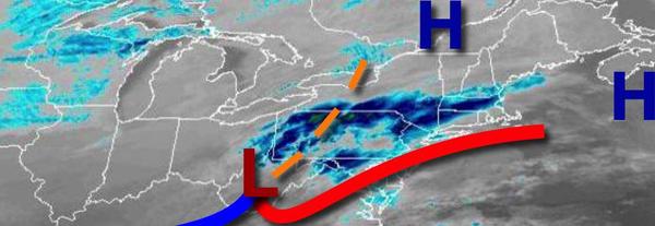
An area of low pressure will approach on Thursday with snow showers developing over the Philadelphia and New York City metropolitan areas and light to moderate steady snow over southern New Jersey. Winds will be from the northeast at 5 to 15 mph. Temperatures will range from the lower to mid-10s over the interior and upper 10s to mid-20s along the coast for lows and mid-20s to lower 30s for highs.
An area of low pressure will pass to the south of the region on Friday with periods of snow expected. Temperatures on Friday will range from the lower to mid-10s over the interior and mid-10s to lower 20s along the coast for lows and lower to mid-20s over the interior and mid to upper 20s along the coast for highs.
High pressure will be in control on Saturday with clear skies to scattered clouds. Temperatures will range from the lower to mid-10s over the interior and upper 10s to lower 20s along the coast for lows and lower to mid-20s over the interior and upper 20s to lower 30s along the coast for highs.
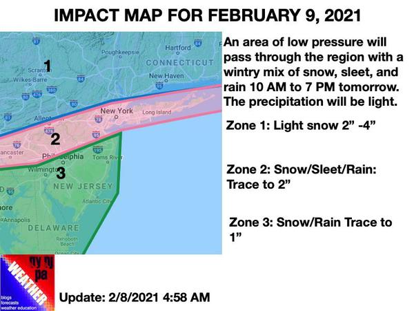
An area of low pressure will produce periods of snow, ice, and rain for the region, possibly heavy at times on Sunday. Temperatures will range from the upper 10s to mid-20s for lows and upper 20s to lower 30s over the interior, lower to mid-30s over the I-95 corridor, and mid-30s to lower 40s along the New Jersey coast.
High pressure will produce clear skies on Monday. Temperatures will range from the single digits to mid-10s for lows and lower to mid-10s over the interior and mid-10s to lower 20s along the coast for highs.
An area of low pressure will approach on Tuesday with periods of snow, sleet, and rain in the afternoon and evening. Temperatures on Tuesday will range from the single digits below zero to single digits above for lows and mid-20s to lower 30s over the interior, lower to mid-30s in the I-95 corridor, and mid-30s to mid-40s on the southern New Jersey coast for highs.