Well, this wouldn't be a winter storm forecast without some sort of trend northward in the forecast for this winter.
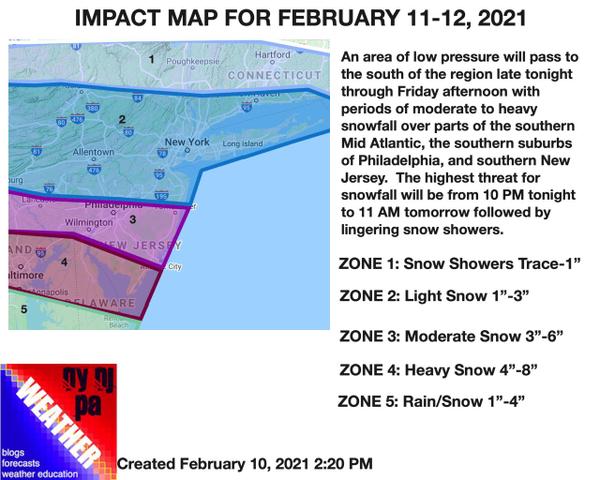
An area of low pressure will pass to the south of the region tonight through tomorrow morning with periods of light to moderate snowfall for much of the New York City and Philadelphia metropolitan areas. A band of heavy snowfall is now expected to be focused from northern Maryland through Delaware and into southern New Jersey with visibility at times below a mile. The majority of the snowfall will develop from 10 PM tonight through 11 AM
tomorrow morning.
Snow showers will linger over the Philadelphia metropolitan area and points to the south for tomorrow afternoon through Friday morning as another wave of low pressure passes through the southern Mid Atlantic.
A break in the wintry weather is expected Friday afternoon through Saturday afternoon with dry and cold conditions. However, another winter storm is likely to impact the region Saturday night through Sunday morning but this time the concern will be ice for much of the I-95 corridor while light snow targets the interior, but let's take one storm at a time.