High pressure will provide a break from the wintry precipitation for today, but more snow is on the way by tomorrow and a wintry mix is likely this weekend.
High pressure will build into the region today with clear skies to scattered cloud cover. Winds will be from the northwest at 5 to 15 mph. Temperatures will rise into the mid-20s to lower 30s for highs this afternoon.
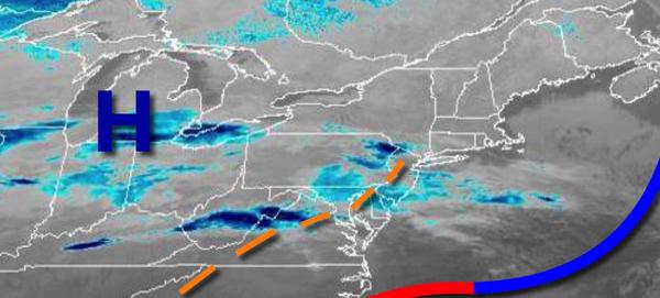
An area of low pressure will approach tonight with snow showers developing over the Philadelphia and New York City metropolitan areas towards midnight and flurries over the interior. Winds will veer to the northeast at 5 to 15 mph. Temperatures will fall into lower to mid-10s over the interior and upper 10s to lower 20s along the coast for lows.
The area of low pressure will pass to the south of the region tomorrow with periods of light snow in the morning hours for southeastern Pennsylvania, central New Jersey, and southern New Jersey. Widely scattered snow showers can be expected for the rest of the region. Winds will be from the northeast at 5 to 15 mph. Temperatures will rise into the mid-20s to lower 30s for highs.
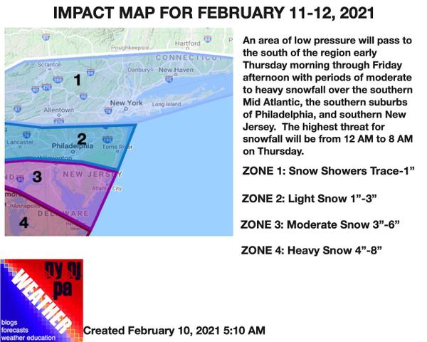
Another area of low pressure will pass to the south on Friday with flurries over much of the region and a few snow showers over southern New Jersey. Winds will be from the northeast at 5 to 15 mph. Temperatures will range from the single digits to mid-10s for lows and lower to mid-20s for highs.