Cold arctic air returns to the region this morning ahead of the next winter storm that will bring accumulating snow to much of the region starting tomorrow.
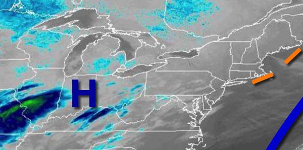
High pressure will pass to the north of the region today with clear skies to scattered cloud cover. Winds will veer from the northwest to the north at 5 to 15 mph. Temperatures will rise into the lower to mid-20s over the interior and upper 20s to lower 30s along the coast for highs.
An area of low pressure will approach tonight from the Gulf Coast with increasing clouds and snow showers developing towards morning. Winds will veer to the northeast at 5 to 15 mph. Temperatures will fall into the mid to upper 10s over the interior and lower to mid-20s along the coast for lows.
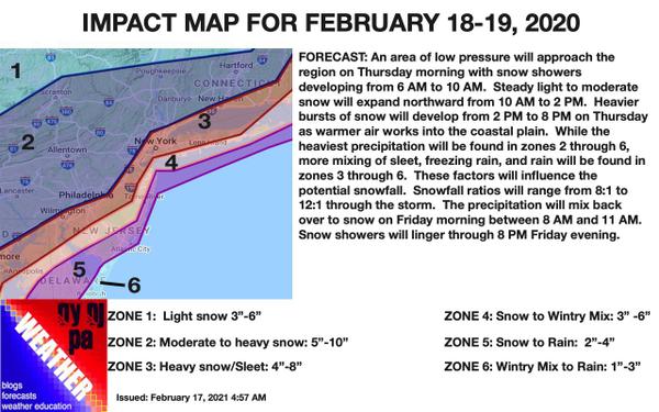
The area of low pressure will track towards the New Jersey coastal waters tomorrow with periods of snow, mixing with sleet and rain at times along the coast. The snow will be heavy at times in the late afternoon and evening hours. Winds will be from the northeast at 5 to 15 mph with gusts up to 25 mph at times. Temperatures will rise into the mid to upper 20s over the interior, upper 20s to lower 30s along the I-95 corridor, and lower to
mid-30s along the coast.
The low-pressure system will slowly exit the region tomorrow night through Friday with lingering snow showers expected throughout the region. Winds will back from the northeast to northwest at 5 to 15 mph. Temperatures on Friday will range from the lower to mid-20s over the interior and mid to upper 20s along the coast for lows and upper 20s to lower 30s over the interior and lower to mid-30s along the coast for highs.