A quiet weather pattern will be in place through the end of the week, but rain and snow return by the weekend.
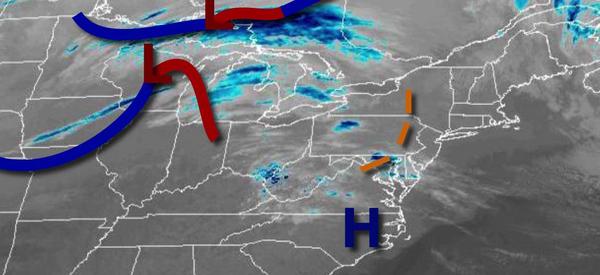
A series of troughs and cold fronts will move through the region today with scattered clouds and an isolated shower possible. Winds will veer from the southwest to northwest at 5 to 15 mph. Temperatures will rise into the mid to upper 40s over the interior and upper 40s to lower 50s along the coast for highs.
High pressure will be in control tomorrow through Friday with clear skies to scattered cloud cover. Winds will be from the northwest at 5 to 15 mph. Temperatures tomorrow will range from the upper 20s to lower 30s over the interior and mid to upper 30s along the coast for lows and upper 30s to lower 40s over the interior and lower to mid-40s along the coast for highs. Temperatures on Friday will range from the single digits to mid-10s
over the interior and upper 10s to mid-20s along the coast for lows and mid to upper 30s for highs.
An area of low pressure will approach on Saturday with periods of rain over the coast and snow mix over to rain over the interior. Snow accumulation of a dusting to two inches will be possible for elevations over 500 feet before a change over to rain. Skies will clear by Saturday evening. Temperatures on Saturday will range from the mid to upper 20s over the interior and lower to mid-30s along the coast for lows and mid to upper 40s over
the interior and upper 40s to lower 50s along the coast for highs.
High pressure will produce scattered clouds on Sunday. Temperatures will range from the upper 20s to lower 30s for lows and lower to mid-40s for highs.
An area of low pressure will produce periods of showers on Sunday night through Monday morning. Temperatures on Monday will range from the mid to upper 30s for lows and mid to upper 40s for highs.
High pressure will produce scattered clouds on Tuesday. Temperatures will range from the mid-10s to lower 20s over the interior and mid-20s to lower 30s along the coast for lows and upper 30s to lower 40s for highs.
An area of low pressure will produce snow changing over to rain over the interior and rain along the coast on Wednesday. Temperatures will range from the lower to mid-20s over the interior and upper 20s to mid-30s along the coast for lows and mid to upper 30s over the interior and lower to mid-40s along the coast for highs.