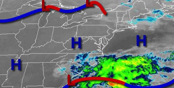
After a brutal arctic blast, temperatures rebound this afternoon, but more chilly conditions are on the way through this weekend.
High pressure will be in control through this afternoon with clear skies to scattered cloud cover. Winds will be from the west at 5 to 15 mph. Temperatures will rise into the mid-40s to lower 50s for highs.
A cold front will follow this evening through tomorrow morning with scattered clouds. Winds will veer to the northwest at 5 to 15 mph. Temperatures will fall into the upper 20s to lower 30s for lows.
High pressure will be in control tomorrow afternoon through Friday with clear skies to scattered clouds. Winds will be from the northwest at 5 to 15 mph. Temperatures tomorrow will rise into the lower to mid-30s over the interior and upper 30s to lower 40s along the coast for highs. Temperatures on Friday will range from the lower to mid-10s over the interior and upper 10s to lower 20s along the coast for lows and upper 20s to mid-30s for
highs.
High pressure will be in control Saturday through Monday with clear skies to scattered clouds. Temperatures will range from the single digits to mid-10s over the interior and upper 10s to mid-20s for lows and mid to upper 20s over the interior and mid-30s to lower 40s for highs through the forecast period.
High pressure will shift off the coast on Tuesday with scattered cloud cover. Temperatures on Tuesday will range from the mid-20s to lower 30s for lows and mid-40s to lower 50s for highs.
A weak cold front will follow on Wednesday with scattered cloud cover. Temperatures on Wednesday will range from the lower to mid-30s for lows and upper 40s to lower 50s over the interior and mid-50s to lower 60s along the coast for highs.