Waves of rainfall are on the way this afternoon and evening. A cold front will bring showers and even a few thunderstorms on Friday morning.
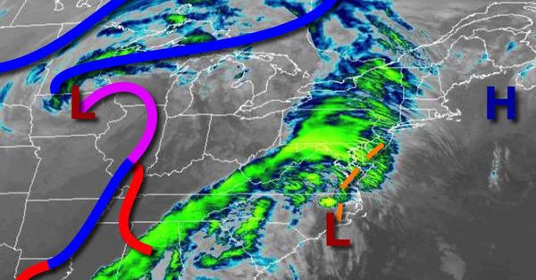
An area of low pressure along the coast will bring periods of moderate to heavy rainfall this afternoon and evening. Rainfall amounts up to 2" will be possible in the Philadelphia and New York City metropolitan areas. Winds will be from the southeast at 5 to 15 mph. Temperatures will rise into the lower to mid-50s along the coast and mid to upper 50s elsewhere for highs.
Scattered to broken clouds with isolated showers can be expected tonight through tomorrow evening. Winds will veer to the south at 5 to 15 mph. Temperatures tomorrow will range from the lower to mid-40s over the interior and mid to upper 40s along the coast for lows and lower to mid-60s along the coast and upper 60s to lower 70s elsewhere for highs.
A strong cold front will move through the region on Friday morning with periods of showers and a few isolated thunderstorms. The thunderstorms will be capable of brief heavy downpours, occasional lightning, and wind gusts up to 40 mph. Skies will clear in the afternoon and evening. Winds will veer from the south to southwest at 10 to 20 mph. Temperatures on Friday will range from the lower to mid-50s along the coast and mid-50s to
lower 60s elsewhere for lows and upper 60s to lower 70s along the immediate coast, lower to mid-70s over the interior, and mid-70s to lower 80s in the Delaware River Valley for highs.
A series of weak cold fronts will move through on Saturday with scattered clouds with isolated showers. Temperatures will range from the upper 30s to mid-40s for lows and upper 50s to mid-60s for highs.
An area of low pressure will produce periods of showers on Sunday afternoon. Temperatures on Sunday will range from the lower to mid-40s for lows and upper 50s to mid-60s along the coast and mid-60s to lower 70s elsewhere for highs.
High pressure will produce scattered clouds on Monday and Tuesday. Temperatures on Monday will range from the lower to mid-30s over the interior and upper 30s to lower 40s along the coast for lows and upper 40s to mid-50s for highs. Temperatures on Tuesday will range from the upper 20s to mid-30s for lows and upper 40s to lower 50s along the coast, lower to mid-50s over the interior, and mid to upper 50s in the Delaware River Valley for
highs.
An area of low pressure will produce scattered showers on Wednesday. Temperatures will range from the mid to upper 40s over the interior and upper 40s to mid-50s along the coast for lows and upper 50s to lower 60s along the coast, lower to mid-60s over the interior, and mid-60s to lower 70s in the Delaware River Valley for highs.