Tranquil conditions are in place for today, but stormy weather conditions return tomorrow with the threat for rain, embedded thunderstorms, and even some higher elevation snowfall by Thursday morning.
High pressure will produce clear skies to scattered clouds through this evening. Winds will be from the west at 5 to 15 mph. Temperatures will rise into the lower to mid-50s on the immediate coast and upper 50s to mid-60s elsewhere for highs.
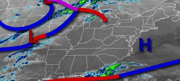
An area of low pressure will approach the region tonight with increasing clouds. Winds will back to the southeast at 5 to 15 mph. Temperatures will fall into the lower to mid-40s over the interior and mid to upper 40s along the coast for lows.
The area of low pressure will approach from the Tennessee River Valley tomorrow with periods of rain, heavy at times, in the afternoon hours. A few embedded thunderstorms will be possible along the coast with intense downpours, isolated lightning, and wind gusts over 40 mph. Winds will be from the southeast at 5 to 15 mph, increasing to 10 to 20 mph in the evening. Temperatures will rise into the mid to upper 50s over the interior and
upper 50s to mid-60s along the coast for highs.
The area of low pressure will lift into New England by Thursday morning with periods of rain for most of the region in the morning, ending by the early afternoon. However, colder air will invade in time over the Poconos and Catskills to allow for a change over to snow with some accumulations on cold surfaces of up to 2" for elevations above 1,500 feet. Skies will clear in the afternoon and evening. Winds will back to the northwest at 10
to 20 mph with gusts over 30 mph at times. Temperatures will range from the lower to mid-30s over the interior and upper 30s to mid-40s along the coast for lows and lower to mid-30s in the Poconos, mid-30s to lower 40s for the rest of the interior, and mid-40s to lower 50s along the coast for highs.
High pressure will pass through the region on Friday and Saturday with scattered clouds. Temperatures on Friday will range from the mid-10s to lower 20s over the interior and mid-20s to lower 30s along the coast for lows and lower to mid-30s over the interior and upper 30s to mid-40s along the coast for highs. Temperatures on Saturday will range from the upper single digits to mid-10s in the Poconos, upper 10s to mid-20s for the rest of the
interior, and upper 20s to lower 30s along the coast for lows and mid-40s to lower 50s for highs.
A weak trough will pass through the region on Sunday, Easter, with scattered clouds and an isolated shower possible. Temperatures will range from the lower to mid-30s over the interior and mid-30s to lower 40s along the coast for lows and lower to mid-50s along the immediate coast, mid to upper 50s over the interior, and upper 50s to mid-60s elsewhere for highs.
A series of weak troughs will pass through the region on Monday and Tuesday with scattered clouds and an isolated shower possible. Temperatures on Monday will range from the lower to mid-30s over the interior and upper 30s to mid-40s along the coast for lows and upper 50s to mid-60s for highs. Temperatures on Tuesday will range from the lower to mid-30s over the interior and upper 30s to mid-40s along the coast for lows and upper 50s to mid-60s
for highs.