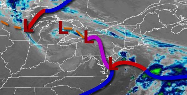
Periods of showers will remain constant through the week with heavy rainfall likely for the end of the week. The cool, unsettled weather pattern will remain a theme for the next weekend.
An area of low pressure will slowly exit off the coast today with broken to overcast skies with isolated to widely scattered showers. Winds will be from the northeast at 5 to 15 mph. Temperatures will rise into the upper 40s to lower 50s for highs this afternoon.
A weak trough will linger over the region tonight through tomorrow with scattered to broken clouds with isolated showers. Winds will be from the northeast at 5 to 15 mph. Temperatures tomorrow will range from the upper 30s to mid-40s for lows and upper 50s to mid-60s for highs.
Another area of low pressure will approach on Wednesday with increasing clouds and periods of rain developing towards the evening. Winds will be from the northeast at 5 to 15 mph. Temperatures on Wednesday will range from the lower to mid-40s for lows and upper 50s to mid-60s for highs.
An area of low pressure will intensify off the New Jersey coast on Thursday with periods of moderate to heavy rainfall throughout the region. The rain will mix with snow for elevations above 1,500 feet on Thursday night into Friday while waves of rainfall continue along the coast. Temperatures on Thursday will range from the lower to mid-40s over the interior and mid-40s to lower 50s along the coast for lows and mid to upper 40s over the
interior and upper 40s to mid-50s along the coast for highs. Temperatures on Friday will range from the lower to mid-30s over the interior and upper 30s to lower 40s along the coast for lows and upper 30s to mid-40s over the interior and mid to upper 40s along the coast for highs.
A series of weak troughs will pass through the region on Saturday and Sunday with scattered to broken clouds and isolated showers. Temperatures on Saturday will range from the upper 20s to lower 30s over the interior and mid to upper 30s along the coast for lows and mid-50s to lower 60s for highs. Temperatures on Sunday will range from the lower to mid-30s over the interior and upper 30s to mid-40s along the coast for lows and upper 50s to
mid-60s for highs.
Another area of low pressure will produce periods of showers, heavy at times on Monday. Temperatures will range from the lower to mid-40s for lows and lower to mid-50s over the interior and mid-50s to lower 60s along the coast for highs.