Dry air invading from New England will bring drier conditions to the region today, but more rain is on the way by Thursday.
A trough will dive through the region this morning with isolated showers followed by clearing skies in the afternoon and evening. Winds will be from the northeast at 5 to 15 mph. Temperatures will rise into the upper 50s to mid-60s for highs this afternoon.
Another weak trough will pass through the region tonight through tomorrow with scattered clouds with isolated showers. Winds will be from the northeast at 5 to 15 mph. Temperatures tomorrow will range from the lower to mid-40s for lows and upper 50s to mid-60s for highs.
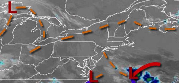
An area of low pressure will approach on Thursday with moderate to heavy rainfall throughout the day. Some snow may mix with rain for the higher elevations on Thursday evening with little to no accumulation expected. Coastal flooding may be a concern in the afternoon and evening. Winds will be from the east at 10 to 20 mph with gusts over 30 mph at times. Temperatures will range from the upper 30s to mid-40s over the interior and
New York City metropolitan area and upper 40s to lower 50s in the Philadelphia metropolitan area for lows and upper 40s to mid-50s over the interior and New York City metropolitan area and mid-50s to lower 60s in the Philadelphia metropolitan area for highs.
The low-pressure system will depart on Friday morning with a mix of rain and snow over the higher elevations, especially the Poconos and Catskills, and rain elsewhere. Skies will clear in the afternoon. Temperatures will range from the mid to upper 30s for lows and lower to mid-40s over the interior and upper 40s to mid-50s for highs along the coast.
A series of weak troughs will pass through the region Saturday through Tuesday with scattered clouds and isolated showers. Temperatures on Saturday will range from the lower to mid-30s over the interior and upper 30s to lower 40s along the coast for lows and upper 40s to mid-50s for highs. Temperatures on Sunday will range from the upper 30s to lower 40s for lows and upper 40s to mid-50s along the coast, lower to mid-50s over the interior, and
mid to upper 50s in the Delaware River Valley for highs. Temperatures on Monday will range from the mid-30s to lower 40s for lows and mid-50s to lower 60s for highs. Temperatures on Tuesday will range from the mid-30s to lower 40s for lows and lower to mid-60s over the interior and mid to upper 60s along the coast for highs.