A series of areas of low pressure will produce variable clouds, showers, thunderstorms, and a wide range of high temperatures throughout the region through tomorrow. A break returns for Thursday, but not for long.
A warm front will slowly lift to the north this morning with periods of showers as a wave of low pressure over the Great Lakes lifts towards the St. Lawrence River Valley. Scattered to broken clouds with isolated to widely scattered showers will linger through this afternoon and evening. Winds will back to the west at 5 to 15 mph. Temperatures will rise into the mid-60s to lower 70s over the interior and New York City metropolitan area,
mid to upper 70s along the New Jersey coast, and upper 70s to lower 80s in the Delaware River Valley for highs.
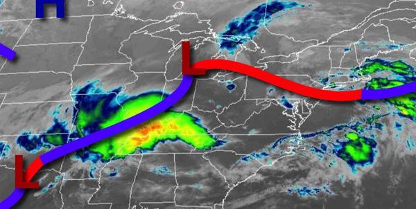
A cold front will approach tonight through tomorrow morning as an area of low pressure in the lower Mississippi River Valley lifts towards the region with areas of low clouds, fog, drizzle, and isolated showers. Winds will back to the southwest at 5 to 15 mph. Temperatures will fall into the lower to mid-50s in Connecticut and Long island, upper 50s to lower 60s over the Poconos, Catskills, and New York City metropolitan areas, and lower to
mid-60s in southeastern Pennsylvania, central New Jersey, and southern New Jersey.
The cold front and area of low pressure will move through the region tomorrow afternoon with periods of showers and strong to severe thunderstorms in the afternoon and evening. The strongest thunderstorms will be found in southeastern Pennsylvania, central New Jersey, and southern New Jersey with heavy downpours, frequent lightning, small hail, and wind gusts over 40 mph. Winds will veer to the northwest at 5 to 15 mph. Temperatures will
rise into the mid-60s to lower 70s on Long Island and southern Connecticut, lower to mid-70s over the interior, and upper 70s to lower 80s in the Delaware River Valley for highs.
High pressure will build into the region on Thursday with clear skies to scattered cloud cover. Winds will be from the northwest at 5 to 15 mph with gusts over 20 mph at times. Temperatures will range from the lower to mid-40s over the interior and upper 40 to lower 50s along the coast for lows and mid to upper 50s over the interior, upper 50s to lower 60s in the New York City metropolitan area, and lower to mid-60s in the Philadelphia
metropolitan area for highs.
A cold front will move through the region on Friday with scattered showers in the morning and early afternoon followed by clearing skies towards evening. Temperatures will range from the upper 30s to mid-40s for lows and upper 40s to mid-50s over the interior, upper 50s to mid-60s in the New York City metropolitan area, and mid to upper 60s in the Philadelphia metropolitan area for highs.
A series of weak cold fronts and troughs will follow on Saturday and Sunday with scattered to broken cloud cover and isolated to widely scattered showers. Temperatures on Saturday will range from the mid-30s to lower 40s over the interior and mid to upper 40s along the coast for lows and mid-50s to lower 60s for highs. Temperatures on Sunday will range from the mid-30s to lower 40s for lows and mid-40s to lower 50s over the interior and upper
50s to mid-60s along the coast for highs.
A weak trough will follow on Monday with isolated showers in the morning followed by clear skies in the afternoon. Temperatures will range from the lower to mid-40s over the interior and mid-40s to lower 50s along the coast for lows and lower to mid-50s over the interior and upper 50s to mid-60s along the coast for highs.
High pressure will produce clear skies to a few clouds on Tuesday. Temperatures will range from the mid-30s to lower 40s for lows and upper 50s to mid-60s for highs.