Tranquil and cool conditions will be in place today, but clouds and showers return once again by tomorrow afternoon through this weekend.
High pressure will produce clear skies to scattered cloud cover. Winds will be from the northwest at 5 to 15 mph. Temperatures will rise into the upper 50s to mid-60s for highs.
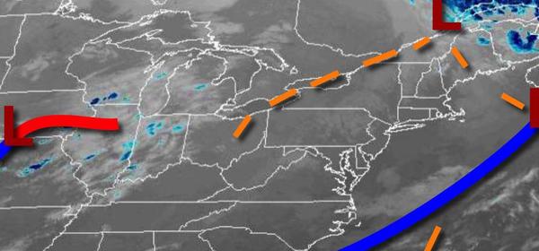
An area of low pressure will approach the region from the Upper Mid West tonight with increasing clouds. Winds will back to the southeast at 5 to 15 mph. Temperatures will fall into the upper 30s to lower 40s over the interior and mid to upper 40s along the coast for lows.
The area of low pressure will pass to the south of the region tomorrow with a trough developing over eastern Pennsylvania which will produce widespread showers over eastern Pennsylvania while clouds will increase along the coast with isolated to widely scattered showers from the Delaware River through eastern Long Island. Winds will be from the southeast at 5 to 15 mph. Temperatures will rise into the upper 50s to mid-60s for
highs.
The trough will slowly march through the region tomorrow night through Saturday with periods of showers, heavy at times. The heaviest rainfall is expected over northeastern Pennsylvania and northwestern New Jersey where up to 1" of rain will be possible due to heavy downpours. The showers will weaken while the trough pushes east towards Connecticut and Long Island in the afternoon and evening. Winds will back from the southeast to
northwest at 5 to 15 mph. Temperatures will range from the upper 30s to mid-40s over the interior and mid to upper 40s along the coast for lows and lower to mid-50s over the interior and mid to upper 50s along the coast for highs.
High pressure will briefly build into the region Saturday night through Sunday afternoon with scattered cloud cover. Temperatures will range from the mid-30s to lower 40s for lows and upper 50s to lower 60s for highs.
An area of low pressure will produce periods of rain Sunday evening through Monday morning followed by clearing skies on Monday afternoon. Temperatures on Monday will range from the lower to mid-40s over the interior and upper 40s to lower 50s along the coast for lows and upper 40s to mid-50s over the interior, upper 50s to mid-60s in the New York City metropolitan area, and mid-60s to lower 70s in the Philadelphia metropolitan area for
highs.
High pressure will be in control on Tuesday and Wednesday with clear skies to scattered cloud cover. Temperatures will range from the lower to mid-30s over the interior and upper 30s to mid-40s along the coast for lows and lower to mid-50s over the interior and upper 50s to mid-60s along the coast for highs.
An area of low pressure will approach on Thursday with increasing cloud cover and showers towards evening. Temperatures will range from the lower to mid-40s over the interior and mid to upper 40s along the coast for lows and lower to mid-50s over the interior and upper 50s to lower 60s along the coast for highs.