Periods of showers will keep weather conditions unsettled through the Mother's Day Weekend, but not a complete washout either.
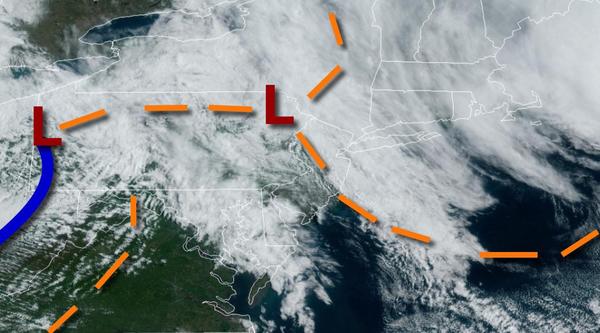
A series of low-pressure systems and troughs will produce scattered clouds to overcast skies with scattered convective showers and thunderstorms. The showers and thunderstorms will be capable of intense downpours and brief wind gusts over 40 mph at times. Winds will back to the northwest at 5 to 15 mph. Temperatures will rise into the lower to mid-50s over the interior, mid to upper 50s in the New York City metropolitan area, and upper
50s to lower 60s in the Philadelphia metropolitan area for highs.
High pressure will build into the region this evening through tomorrow morning with clear skies to scattered clouds. Winds will be from the northwest at 5 to 15 mph. Temperatures will fall into the mid to upper 30s over the interior and lower to mid-40s along the coast for lows.
Another area of low pressure will approach tomorrow with increasing clouds and showers developing in the late afternoon through the evening hours. Winds will back to the southwest at 5 to 15 mph. Temperatures tomorrow will rise into the mid to upper 50s over the interior and upper 50s to lower 60s along the coast for highs.
An area of low pressure will pass through the region tomorrow night through Monday morning with periods of showers. Skies will clear in the afternoon and evening on Monday. Winds will be from the northwest at 5 to 15 mph. Temperatures on Monday will range from the lower to mid-40s over the interior and upper 40s to mid-50s along the coast for lows and lower to mid-50s over the interior and upper 50s to mid-60s along the coast for
highs.
High pressure will produce clear skies to scattered cloud cover Tuesday and Wednesday. Temperatures will range from the mid to upper 30s over the interior and lower to mid-40s along the coast for lows and lower to mid-50s over the interior and upper 50s to mid-60s along the coast for highs.
An area of low pressure will approach on Thursday with increasing clouds and scattered showers by the evening. Temperatures on Thursday will range from the mid to upper 30s over the interior and lower to mid-40s along the coast for lows and lower to mid-60s over the interior and mid to upper 60s along the coast for highs.
An area of low pressure will pass through the region on Friday and Saturday with periods of showers, heavy at times. Temperatures on Friday will range from the mid-40s to lower 50s for lows and lower to mid-60s over the interior, lower to mid-60s along the coast, and mid-60s to lower 70s in the Delaware River Valley for highs. Temperatures on Saturday will range from the upper 40s to mid-50s for lows and mid to upper 50s over the interior,
upper 50s to mid-60s along the coast, and mid to upper 60s in the Delaware River Valley for highs.