Tranquil conditions will be in place to end the week, but a volatile weather pattern is on the way with significant temperature swings and increasing threats for rainfall.
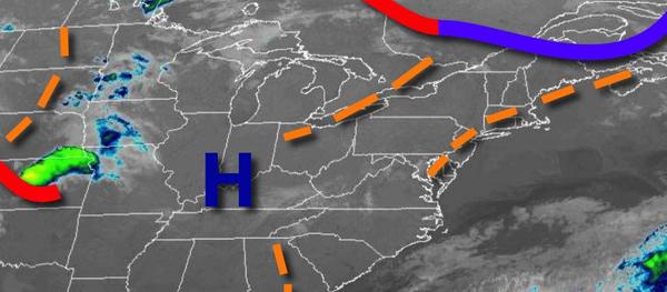
High pressure will pass through the region today through tomorrow with scattered cloud cover. An isolated shower will be a threat in the afternoon hours, however, most locations will remain dry. The shower will be capable of only very light rainfall. Winds will be from the northwest at 5 to 15 mph. Temperatures will rise into the mid-60s to lower 70s for highs this afternoon. Temperatures tomorrow will range from the mid-40s
to lower 50s for lows and mid-60s to lower 70s over the interior and lower to mid-70s along the coast for highs.
A stronger trough will pass through the region on Sunday with scattered to broken cloud cover and widely scattered showers and isolated thunderstorms. The thunderstorms will be capable of a brief heavy downpour, isolated lightning strikes, and wind gusts up to 40 mph. Winds will be from the southwest at 5 to 15 mph. Temperatures will range from the lower to mid-40s over the interior and mid to upper 40s along the coast for lows and upper
60s to mid-70s for highs.
A series of weak troughs will pass through the region Monday and Tuesday with scattered clouds and isolated showers. Temperatures on Monday will range from the mid-40s to lower 50s for lows and mid-60s to lower 70s for highs. Temperatures on Tuesday will range from the upper 40s to mid-50s for lows and upper 60s to mid-70s for highs.
A warm front will lift through the region on Wednesday with scattered to broken cloud cover, morning fog, and isolated to widely scattered showers. Temperatures will range from the mid to upper 50s for lows and mid-70s to lower 80s for highs.
The warm front will stall over the region on Thursday with scattered to broken cloud cover, morning fog, and isolated showers. Temperatures will range from the mid-50s to lower 60s for lows and mid-70s to lower 80s for highs.
A cold front will drop south and east on Friday with periods of rain expected. Temperatures will range from the upper 50s to mid-60s for lows and mid to upper 60s over the interior and New York City metropolitan area, lower to mid-70s in the Philadelphia metropolitan area, and mid-70s to lower 80s over southern New Jersey for highs.