Dry conditions will be in place throughout the week with volatile temperature swings. A threat for showers and thunderstorms returns this weekend with wild swings in high temperatures.
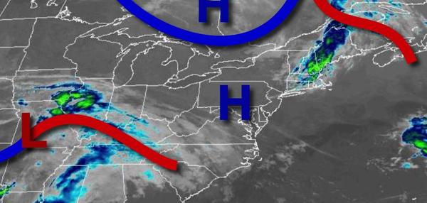
High pressure will be in control today through Thursday with clear skies to scattered clouds. Locally dense fog is a threat in the morning hours. Winds will be light and variable throughout the period. Temperatures will rise into the lower to mid-70s over the interior and mid-70s to lower 80s along the coast for highs. Temperatures tomorrow will range from the lower to mid-50s over the interior and mid to upper 50s along the coast
for lows and upper 70s to mid-80s along the coast, lower to mid-80s over the interior, and mid-80s to lower 90s in the Delaware River Valley for highs. Temperatures on Thursday will range from the mid-50s to lower 60s for lows and upper 60s to mid-70s along the coast, mid to upper 70s over the interior, and upper 70s to mid-80s in the Delaware River Valley for highs.
High pressure will slowly exit on Friday with clear skies to scattered cloud cover. Temperatures will range from the lower to mid-50s over the interior and mid to upper 50s along the coast for lows and mid-60s to lower 70s in the New York City metropolitan area, lower to mid-70s over the interior, and mid to upper 70s in the Delaware River Valley for highs.
A frontal boundary will waver over the region Saturday through Monday with areas of fog in the morning, scattered to broken clouds in the afternoon, and isolated to widely scattered showers and thunderstorms. Temperatures on Saturday will range from the upper 50s to mid-60s for lows and mid-70s to lower 80s over the interior and New York City metropolitan area and lower to mid-80s in the Philadelphia metropolitan area for highs. Temperatures on
Sunday will range from the mid-50s to lower 60s over the interior and lower to mid-60s along the coast for lows and upper 70s to lower 80s over the interior and New York City metropolitan areas and mid-80s to lower 90s in the Philadelphia metropolitan areas for highs. Temperatures on Monday will range from the upper 40s to mid-50s over the interior and upper 50s to lower 60s along the coast for lows and mid-60s to lower 70s over the interior and New York City metropolitan areas and mid to
upper 70s in the Philadelphia metropolitan area for highs.
A warm front will slowly lift through the region with widespread showers and thunderstorms on Tuesday. Temperatures will range from the mid-50s to lower 60s for lows and mid-70s to lower 80s in the New York City metropolitan area and interior and mid-80s to lower 90s in the Philadelphia metropolitan area for highs.