Hot and humid conditions will give way to thunderstorms this afternoon and evening. Unsettled conditions are expected for the Memorial Day Weekend.
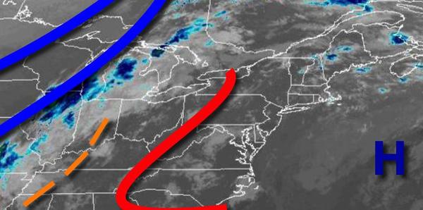
A cold front will approach the region today with low clouds and fog giving way to scattered clouds by noon. Showers and thunderstorms will develop this afternoon and evening with thunderstorms capable of heavy downpours, frequent lightning, small hail, and wind gusts over 40 mph. Winds will be from the southwest at 5 to 15 mph. Temperatures will rise into the mid-70s to lower 80s on Long Island and mid-80s to lower 90s elsewhere for highs
with humid conditions.
The cold front will clear the region tonight through early tomorrow morning with scattered showers followed by clearing skies towards morning. Winds will veer to the northwest at 5 to 15 mph. Temperatures will fall into the lower to mid-60s over the interior and mid-60s to lower 70s elsewhere for lows.
High pressure will briefly produce clear skies to scattered clouds tomorrow afternoon and evening. winds will veer to the north at 5 to 15 mph. Temperatures tomorrow will rise into the mid-70s to lower 80s over the interior, lower to mid-80s on the coast, and mid-80s to lower 90s in the Delaware River Valley for highs.
An area of low pressure will approach the region on Friday with periods of rain in the afternoon and evening. Winds will be from the northeast at 5 to 15 mph. Temperatures will range from the upper 40s to lower 50s over the interior and mid-50s to lower 60s along the coast for lows and upper 60s to lower 70s over the interior, mid-60s to lower 70s along the coast, and mid to upper 70s in the Delaware River Valley for highs.
The area of low pressure will exit on Saturday with showers lingering in the morning followed by scattered to broken clouds with lingering drizzle in the afternoon and evening. Temperatures will range from the mid to upper 40s over the interior and lower to mid-50s along the coast for lows and mid to upper 50s for highs.
A frontal boundary will linger over the coastal waters with waves of low pressure while high pressure will remain in control over New England which will produce onshore winds, morning fog, variable clouds, and isolated to widely scattered showers on Sunday and Memorial Day Monday. If the high-pressure system is stronger, dry conditions will dominate, however, if the surface low-pressure system is closer to the coast, showers will become more
widespread. Temperatures will range from the mid to upper 40s over the interior and lower to mid-50s along the coast for lows and mid-50s to lower 60s over the interior and upper 50s to mid-60s along the coast for highs.
High pressure will be in control on Tuesday and Wednesday with scattered clouds expected. Temperatures will range from the mid-40s to lower 50s for lows and lower to mid-70s over the interior, mid to upper 70s on the coast, and upper 70s to lower 80s in the Delaware River Valley for highs on Tuesday. Temperatures on Wednesday will range from the mid-50s to lower 60s for lows and lower to mid-70s for highs.