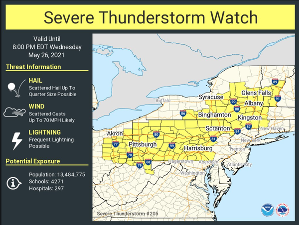
 The NWS Storm Prediction Center has issued a

   * Severe Thunderstorm Watch for portions of
     Western Connecticut
     Western Massachusetts
     Central and Eastern New York
     Eastern Ohio
     Much of Pennsylvania
     Southern Vermont
     Northern West Virginia

   * Effective this Wednesday afternoon and evening from 100 PM
     until 800 PM EDT.

   * Primary threats include...
     Scattered damaging wind gusts to 70 mph likely
     Scattered large hail events to 1 inch in diameter possible

   SUMMARY...Scattered thunderstorms will continue to develop through
   the afternoon in a warm/humid air mass.  The strongest storms will
   pose a risk of gusty/damaging wind gusts through early evening.

   The severe thunderstorm watch area is approximately along and 75
   statute miles north and south of a line from 50 miles south
   southwest of Akron OH to 45 miles northeast of Pittsfield MA. For a
   complete depiction of the watch see the associated watch outline
   update (WOUS64 KWNS WOU5).