Waves of showers and thunderstorms will be a threat through tomorrow followed by a tropical weather pattern returning for the first time this Summer through next week.
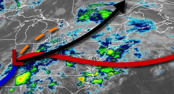
As an area of low pressure lifts north towards the eastern Great Lakes this afternoon, a warm front will lift north with waves of showers and strong to severe thunderstorms this morning. A break in the thunderstorms can be expected from 11 AM to 2 PM followed by another round of showers and thunderstorms through the afternoon and evening. The thunderstorms will be capable of intense downpour, frequent lightning, small hail, and wind gusts over
40 mph. Flash flooding may be a threat in some thunderstorms. Winds will veer to the southwest at 5 to 15 mph. Temperatures will rise into the upper 60s to mid-70s along the coast, lower to mid-70s over the interior, and mid-70s to lower 80s in the Delaware River Valley for highs.
The cold front will slowly approach the region tonight through tomorrow morning with scattered showers and thunderstorms. Winds will be from the southwest at 5 to 15 mph. Temperatures will fall into the lower to mid-60s over the interior and mid to upper 60s along the coast for lows.
The cold front will move through the region tomorrow afternoon with scattered to broken clouds cover along with isolated to widely scattered showers and thunderstorms. Winds will be from the southwest at 5 to 15 mph. Temperatures will rise into the lower to mid-70s over the interior and upper 70s to lower 80s elsewhere for highs.
A weak trough will linger over the region on Saturday with areas of fog and low clouds in the morning giving way to scattered clouds and isolated thunderstorms in the afternoon and evening. Winds will be from the southwest at 5 to 15 mph. Temperatures will range from the lower to mid-60s for lows and upper 70s to mid-80s for highs.
A trough will linger over the region on Sunday with areas of fog and low clouds in the morning and scattered clouds and isolated thunderstorms in the afternoon and evening. Temperatures on Sunday will range from the lower to mid-60s for lows and lower to mid-80s along the coast and mid-80s to lower 90s elsewhere for highs.
A humid tropical-like air mass will be in place on Monday through Thursday with areas of fog and low clouds in the morning giving way to scattered clouds and isolated thunderstorms in the afternoon. Temperatures will range from the mid to upper 60s over the interior, mid-60s to lower 70s along the coast, and upper 60s to mid-70s in the Delaware River Valley for lows and upper 70s to mid-80s along the coast, mid to upper 80s over the interior, and
upper 80s to lower 90s in the Delaware River Valley for highs.