The first weekend of June will feature hot and tranquil conditions, perfect for that first trip to the beach or the park. The threat for thunderstorms returns next week before a turn to cooler weather once again.
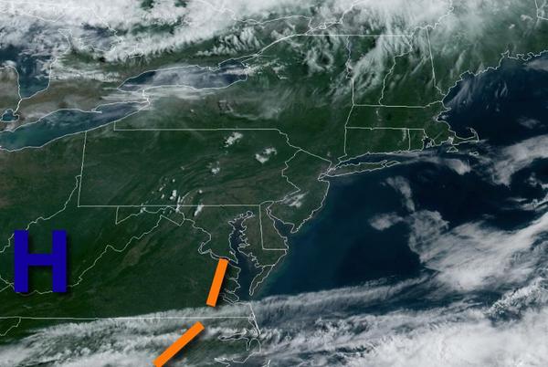
High pressure will be in control today through tomorrow with clear skies to scattered cloud cover. Some fog may be a threat tomorrow morning with visibility below 2 miles at times. Winds will be from the southwest at 5 to 10 mph, with a sea breeze possible in the afternoons with winds from the east at 5 to 15 mph. Temperatures will rise into the upper 70s to mid-80s along the coast, lower to mid-80s over the higher elevations, and upper
80s to lower 90s in the Delaware River Valley. Temperatures tomorrow will range from the mid to upper 60s for lows and upper 70s to mid-80s along the coast, mid to upper 80s over the interior, and upper 80s to lower 90s in the Delaware River Valley for highs.
A trough will drop through the region on Monday with low clouds and fog in the morning and isolated showers and thunderstorms in the afternoon. The thunderstorms will be capable of heavy downpours, frequent lightning, and wind gusts over 40 mph. Winds will be from the southwest at 5 to 15 mph. Temperatures will range from the mid to upper 60s for lows and mid-70s to lower 80s on Long Island, lower to mid-80s on the coast, and mid-80s to
lower 90s away from the coast for highs.
A cold front will slowly drop through the region on Tuesday and Wednesday with areas of fog in the morning hours and widely scattered to scattered showers and strong to severe thunderstorms. The thunderstorms will be capable of tropical downpours, frequent lightning, small hail, and wind gusts over 40 mph. Temperatures on Tuesday will range from the mid-60s to lower 70s for lows and mid to upper 80s for highs. Temperatures on Wednesday will
range from the upper 60s to mid-70s for lows and mid-70s to lower 80s along the coast and mid to upper 80s away from the coast.
The cold front will stall to the south of the region on Thursday with scattered to broken cloud cover and isolated to widely scattered showers. Temperatures will range from the lower to mid-60s over the interior and New York City metropolitan area and upper 60s to lower 70s in the Philadelphia metropolitan area and southern New Jersey for lows and upper 60s to mid-70s over the interior and New York City metropolitan area and upper 70s to lower 80s in
the Philadelphia metropolitan area and southern New Jersey for highs.
High pressure to the north and a stalled cold front to the south will produce onshore winds Friday and Saturday along with scattered to broken clouds and isolated showers. Temperatures on Friday will range from the upper 50s to mid-60s for lows and upper 60s to mid-70s along the coast and mid to upper 70s away from the coast for highs. Temperatures on Saturday will range from the mid-50s to lower 60s for lows and lower to mid-70s along the
coast and mid to upper 70s away from the coast for highs.