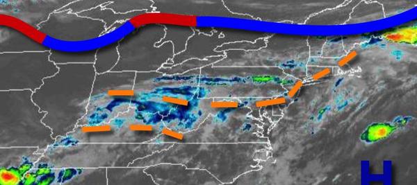
A cold front dropping south from New England will bring another round of showers and thunderstorms after a foggy start to the day. A cooler weather pattern returns for tomorrow through this weekend.
A cold front will drop south today with fog and low clouds this morning giving way to scattered showers and strong to severe thunderstorms. The thunderstorms will be capable of torrential downpours, frequent lightning, hail, and wind gusts over 40 mph. Winds will veer from the southwest to the northwest at 5 to 15 mph. Temperatures will rise into the upper 70s to mid-80s along the coast, lower to mid-80s over the interior, and mid to
upper 80s in the Delaware River Valley for highs.
The cold front will stall to the south of the region tonight through Friday while high pressure over the Canadian Maritimes builds south which will produce scattered to broken cloud cover and isolated to widely scattered showers. Winds will veer from the northeast to east at 5 to 15 mph. Temperatures tomorrow will range from the mid-60s to lower 70s for lows and mid-70s to lower 80s for highs. Temperatures on Friday will range from the
mid-50s to lower 60s for lows and upper 60s to mid-70s for highs.
The cold front boundary will remain stalled to the south of the region with waves of low pressure while high pressure remains over the Canadian Maritimes and northern New England which will produce scattered to broken cloud cover and isolated to widely scattered showers Saturday through Wednesday. Temperatures on Saturday will range from the mid to upper 50s for lows and upper 60s to mid-70s along the coast, mid to upper 70s over the interior, and
upper 70s to mid-80s in the Delaware River Valley for highs. Temperatures on Sunday will range from the upper 50s to mid-60s for lows and lower to mid-70s along the coast and mid-70s to lower 80s away from the coast for highs. Temperatures on Monday will range from the upper 50s to mid-60s for lows and upper 70s to mid-80s for highs. Temperatures on Tuesday will range from the lower to mid-50s over the interior and upper 50s to lower 60s along the coast for lows and lower to
mid-70s over the interior and upper 70s to mid-80s along the coast for highs. Temperatures on Wednesday will range from the upper 40s to lower 50s over the interior and mid to upper 50s along the coast for lows and mid-60s to lower 70s over the interior, upper 60s to mid70s along the coast, and mid to upper 70s in the Delaware River Valley for highs.