After a hot and humid start to the week, a cool maritime air mass is now in control and will remain in place through the weekend.
The combination of high pressure to the north and waves of low pressure to the south will support scattered to overcast cloud cover, isolated showers, and an easterly wind at 5 to 10 mph. Temperatures will rise into the upper 60s to lower 70s for highs.
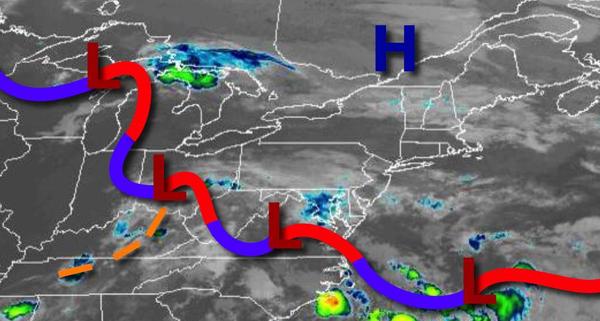
The stationary front will waver to the south of the region tonight through Sunday with low clouds and fog in the morning and scattered to broken cloud cover with isolated showers in the afternoon. Winds will veer from the east to the southeast at 5 to 15 mph. Temperatures tomorrow will range from the mid-50s to lower 60s for lows and upper 60s to lower 70s along the coast and mid-70s to lower 80s away from the coast for highs.
Temperatures on Sunday will range from the mid-50s to lower 60s for lows and lower to mid-70s for highs.
A cold front will move through the region on Monday with periods of showers, heavy at times. Temperatures will range from the upper 50s to mid-60s for lows and upper 60s to lower 70s along the coast and mid to upper 70s away from the coast for highs.
A series of weak cold fronts and troughs will pass through the region on Tuesday through Friday with scattered clouds and isolated showers. Temperatures on Tuesday will range from the mid to upper 50s over the interior and lower to mid-60s along the coast for lows and lower to mid-70s over the interior and mid-70s to lower 80s along the coast for highs. Temperatures on Wednesday will range from the mid-50s to lower 60s for lows and upper 60s to
mid-70s over the interior and mid-70s to lower 80s along the coast for highs. Temperatures on Thursday will range from the upper 40s to lower 50s over the interior and mid to upper 50s along the coast for lows and lower to mid-70s over the interior and mid to upper 70s along the coast for highs. Temperatures on Friday will range from the upper 50s to lower 60s over the interior and lower to mid-60s along the coast for lows and lower to mid-80s along the coast and mid to upper 80s
away from the coast for highs.