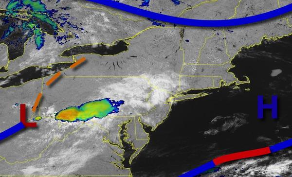
Periods of showers and thunderstorms will be on the way by tonight as a wave of low pressure passes through the region. An active weather pattern will continue through next week.
An area of low pressure will approach the region today with increasing clouds and a few isolated showers through this afternoon and evening. Winds will veer to the southeast at 5 to 15 mph. Temperatures will rise into the lower to mid-70s along the coast and mid-70s to lower 80s away from the coast for highs.
An area of low pressure and cold front will follow tonight through tomorrow with waves of showers and thunderstorms. The thunderstorms will be capable of heavy downpours, occasional lightning, and wind gusts over 40 mph at times. Winds will veer from the south to the northwest at 5 to 15 mph. Temperatures will range from the lower to mid-60s for lows and upper 60s to mid-70 along the coast, mid to upper 70s over the interior, and upper
70s to mid-80s in the Delaware River Valley for highs.
A trough will follow on Tuesday with scattered showers. Winds will veer to the northwest at 5 to 15 mph. Temperatures will range from the mid-50s to lower 60s for lows and mid-70s to lower 80s for highs.
High pressure will be in control on Wednesday and Thursday with clear skies to scattered cloud cover. Temperatures on Wednesday will range from the lower to mid-50s over the interior and upper 50s to lower 60s along the coast for lows and lower to mid-70s along the coast and mid-70s to lower 80s away from the coast for highs. Temperatures on Thursday will range from the upper 40s to lower 50s over the interior and lower to mid-50s along the
coast for lows and lower to mid-70s along the coast and mid-70s to lower 80s away from the coast for highs.
A series of weak troughs and cold fronts will follow on Friday through Sunday with widely scattered to scattered showers. Temperatures on Friday will range from the lower to mid-50s for lows and mid-70s to lower 80s for highs. Temperatures on Saturday will range from the lower to mid-60s for lows and mid to upper 70s along the coast and upper 70s to mid-80s away from the coast for highs. Temperatures on Sunday will range from the mid-60s
to lower 70s for lows and mid-70s to lower 80s over the interior and lower to mid-80s along the coast for highs.