This morning has already featured a steady increase in humidity, and more is on the way. The new weather pattern will feature morning fog, afternoon thunderstorms, and a heat index in the mid-90s to lower 100s.
High pressure will strengthen over the coastal waters today while weak trough stalls over the region which will produce areas of fog in the morning and a mix of sun and clouds with isolated thunderstorms in the afternoon. The thunderstorms will be capable of intense downpours, frequent lightning, and wind gusts over 40 mph. Winds will be from the south at 10 to 20 mph. Temperatures will rise into the mid-70s to lower 80s along the coast
and lower to mid-80s away from the coast for highs with increasing humidity.
The high-pressure system will settle off the coastal waters with areas of fog in the morning and a mix of sun and clouds in the afternoon tonight through tomorrow. An isolated thunderstorm will be possible in the afternoon. Winds will be from the south at 5 to 10 mph in the morning, increasing to 10 to 20 mph in the afternoon. Temperatures will range from the upper 60s to mid-70s for lows and upper 70s to mid-80s along the coast and
mid-80s to lower 90s away from the coast for highs. A heat index in the mid-90s to lower 100s will be possible.
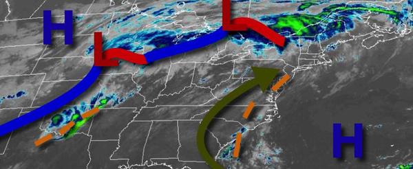
A tropical weather pattern will be locked in over the region Monday through Thursday with a strong Bermuda high-pressure system to the east and weak, stalling cold fronts and troughs to the west. As a result, locally dense fog will be a threat in the morning hours while muggy conditions with a mix of sun and clouds along with isolated thunderstorms can be expected in the afternoon and early evening. Winds will be from the south-southwest at 5
to 10 mph in the morning hours and 10 to 20 mph in the evening hours. Temperatures through the period will range from the upper 60s to mid-70s for lows and lower to mid-80s along the immediate coast and upper 80s to mid-90s away from the coast for highs. A heat index in the mid-90s to lower 100s will be likely away from the coast through the period, especially in the Delaware River Valley.
A strong cold front will slowly press south into the region with widespread showers and thunderstorms over the interior and isolated to widely scattered thunderstorms along the coast. The thunderstorms will be capable of heavy downpours, frequent lightning, and wind gusts over 40 mph. Temperatures will range from the upper 60s to lower 70s over the interior and mid-70s to lower 80s along the coast for lows and upper 70s to mid-80s along the
coast, upper 80s to lower 90s in the Delaware River Valley, and lower to mid-80s over the interior for highs.
The cold front will continue to slowly sink through the region on Saturday with scattered showers and thunderstorms capable of heavy downpours. Temperatures on Saturday will range from the upper 60s to mid-70s for lows and upper 70s to lower 80s over the interior and mid to upper 80s along the coast for highs.