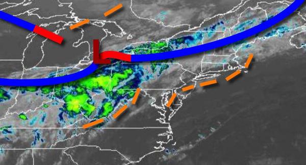
Flash flooding will be a threat as a cold front and waves of thunderstorms move through the region through tomorrow with rainfall amounts of one to three inches expected along the coast. Unsettled conditions are expected through the Fourth of July weekend.
The strong cold front and wave of low pressure will approach the region today with showers and thunderstorms redeveloping this afternoon and continuing through this evening. The thunderstorms will be capable of intense downpours, frequent lightning, and wind gusts over 60 mph at times. Winds will be from the southwest at 5 to 15 mph. Temperatures will rise into the lower to mid-70s over the interior, upper 70s to mid-80s in the New York
City metropolitan area, and mid-80s to lower 90s in the Philadelphia metropolitan area for highs.
The cold front will drop through the region tomorrow with waves of showers and thunderstorms through the morning followed by scattered cloud cover and isolated showers in the afternoon and evening. Winds will veer to the northwest at 5 to 15 mph. Temperatures tomorrow will range from the lower to mid-60s over the interior and upper 60s to lower 70s along the coast for lows and lower to mid-70s over the interior and upper 70s to lower 80s along
the coast for highs.
A stationary cold front over the coastal waters and waves of low-pressure will produce scattered to broken cloud cover and isolated to widely scattered showers tomorrow night through Sunday. Winds will be from the northwest at 5 to 15 mph. Temperatures on Saturday will range from the upper 50s to lower 60s for lows and upper 60s to lower 70s over the interior, upper 60s to mid-70s along the coast, and upper 70s to lower 80s in the Delaware
River Valley for highs. Temperatures on Sunday will range from the mid-50s to lower 60s for lows and lower to mid-70s along the coast and mid-70s to lower 80s away from the coast for highs.
The low-pressure system will depart on Monday with scattered clouds and isolated showers. Temperatures will range from the lower to mid-60s for lows and mid-70s to lower 80s over the interior and New York City metropolitan area and mid to upper 80s in the Philadelphia metropolitan area for highs.
A warm front will lift through the region on Tuesday and Wednesday with scattered clouds and isolated thunderstorms. Temperatures on Tuesday will range from the upper 60s to lower 70s for lows and lower to mid-80s along the coast and mid-80s to lower 90s away from the coast for highs. Temperatures on Wednesday will range from the upper 60s to mid-70s for lows and upper 70s to mid-80s over the interior, lower to mid-80s along the coast, and
upper 80s to lower 90s in the Delaware River Valley for highs.
A cold front will follow on Thursday with scattered showers and thunderstorms. Temperatures on Thursday will range from the lower to mid-60s over the interior and upper 60s to mid-70s along the coast for lows and upper 70s to lower 80s over the interior and lower to mid-80s along the coast for highs.