Tranquil conditions today will give way to an active, tropical weather pattern with a heat index over 100 degrees and a threat for thunderstorms.
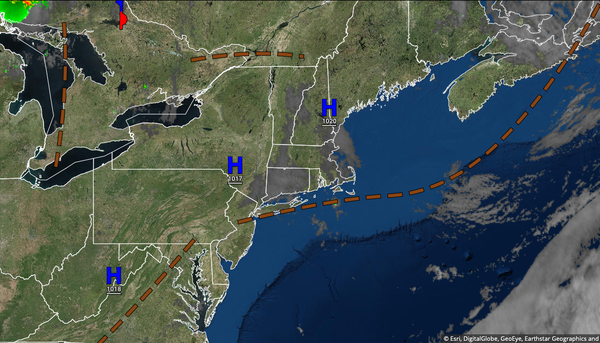
High pressure will produce clear skies to scattered cloud cover through this evening with light and variable winds. Temperatures will rise into the upper 70s to lower 80s on the coast and mid to upper 80s away from the coast for highs today.
A tropical air mass will invade tonight through Wednesday with locally dense fog in the morning and isolated to widely scattered showers and thunderstorms in the afternoon. The thunderstorms will be capable of torrential downpours, frequent lightning, and wind gusts over 40 mph. Temperatures tomorrow will range from the upper 60s to lower 70s for lows and lower to mid-80s along the coast and upper 80s to lower 90s away from the coast for
highs. Temperatures on Wednesday will range from the upper 60s to mid-70s for lows and mid to upper 80s along the coast and upper 80s to mid-90s away from the coast for highs. Due to high levels of humidity, a heat index of 100 to 105 degrees is expected in the urban areas and along the I-95 corridor.
A cold front will approach on Thursday with fog in the morning followed by scattered to widespread showers and thunderstorms. Temperatures on Thursday will range from the upper 60s to mid-70s for lows and lower to mid-80s along the coast, lower to mid-80s over the interior, and upper 80s to lower 90s in the Delaware River Valley for highs.
The cold front will slowly drop through the region on Friday with some interaction from Tropical Storm Elsa producing widespread showers and thunderstorms capable of tropical downpours. Temperatures on Friday will range from the mid-60s to lower 70s for lows and lower to mid-80s over the coast and higher elevations and mid-80s to lower 90s in the Delaware River Valley for highs.
A trough will linger over the region on Saturday with scattered clouds and isolated showers and thunderstorms in the afternoon. Temperatures will range from the mid-60s to lower 70s for lows and upper 70s to lower 80s over the interior, lower to mid-80s along the coast, and mid-80s to lower 90s in the Delaware River Valley for highs.
A strong cold front will slowly move through the region on Sunday and Monday with waves of showers and thunderstorms. Temperatures on Sunday will range from the lower to mid-60s over the interior and upper 60s to lower 70s along the coast for lows and upper 70s to lower 80s over the interior, lower to mid-80s along the coast, and mid-80s to lower 90s in the Delaware River Valley for highs. Temperatures on Monday will range from the upper 60s to
lower 70s over the interior and mid to upper 70s along the coast for lows and lower to mid-80s over the interior and along the coast and mid to upper 80s in the Delaware River Valley for highs.