A series of cold fronts will gradually introduce a cooler weather pattern along with the threat of showers and thunderstorms.
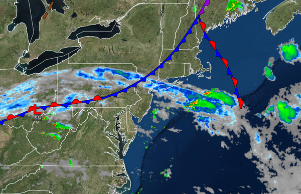
A cold front and wave of low pressure will gradually drop through the region today with scattered cloud cover and isolated to widely scattered showers and thunderstorms. The thunderstorms will be capable of heavy downpours, frequent lightning, and wind gusts over 40 mph. Winds will veer to the northwest at 5 to 10 mph. Temperatures will rise into the lower to mid-80s over the higher elevations and along the coast and upper 80s to lower
90s in the Delaware River Valley for highs.
The cold front will stall over the region tonight through tomorrow with scattered to broken cloud cover and isolated showers. Winds will be from the west at 5 to 15 mph. Temperatures will range from the mid to upper 60s for lows and mid to upper 80s over the interior and immediate coast and upper 80s to mid-90s in the Delaware River Valley for highs.
Another cold front will slowly move through the region on Wednesday with broken to overcast cloud cover and scattered showers. Winds will veer from the west to the northeast at 5 to 15 mph. Temperatures will range from the mid-60s to lower 70s for lows and upper 70s to lower 80s over the interior, lower to mid-80s along the coast, and mid to upper 80s in the Delaware River Valley for highs.
A stronger cold front will follow on Thursday with periods of showers expected. Temperatures will range from the upper 50s to lower 60s over the interior and mid to upper 60s along the coast for lows and upper 70s to mid-80s over the interior, mid to upper 80s in the Delaware River Valley, and mid-70s to lower 80s along the coast for highs.
A weak trough will pass through the region on Friday with scattered clouds and isolated showers. Temperatures will range from the lower to mid-60s over the interior and upper 60s to lower 70s along the coast for lows and mid-70s to lower 80s over the interior, lower to mid-80s along the coast, and mid to upper 80s in the Delaware River Valley for highs.
High pressure will be in control on Saturday and Sunday with clear skies to scattered clouds along with low humidity. Temperatures on Saturday will range from the lower to mid-50s over the interior and upper 50s to lower 60s along the coast for lows and upper 60s to mid-70s along the coast and mid-70s to lower 80s away from the coast for highs. Temperatures on Sunday will range from the lower to mid-50s over the interior and upper 50s to
mid-60s along the coast for lows and upper 70s to mid-80s along the coast, lower to mid-80s over the interior, and upper 80s to lower 90s in the Delaware River Valley for highs.
A cold front will follow on Monday with isolated to widely scattered showers. Temperatures will range from the lower to mid-60s over the interior and upper 60s to mid-70s along the coast for lows and lower to mid-70s over the interior, upper 70s to lower 80s along the coast, and mid-80s in the Delaware River Valley for highs.