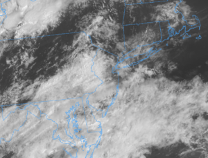
A front lingering around the region will be responsible for a wet and cool first half of the week. There will be numerous chances of showers and thunderstorms with below-average temperatures. Southwest flow returns as we approach the weekend and will bring more summer-like conditions back to the region.
Sunday: A dreary day is ahead with clouds giving way to showers and thunderstorms. Some storms may be severe. High temperatures will range from the low to upper 70s. Overnight lows will be in the mid-50s to lower 60s. Some mountain locations may dip into the low 50s. Winds will be from the SSE at 5-10 mph.
Monday: A dry and sunny day is expected after a cold front swing through the region Sunday night. Highs will rise into the mid-70s to low 80s. Overnight lows will range from the mid-50s to the lower 60s. Winds will be from the NW at 5-10 mph.
Tuesday: Another relatively dry day is expected but some scattered showers can't be ruled out, especially for southern locations, because a front will stall just off the New Jersey coast. High temperatures will be in the mid-70s to low 80s. Very comfortable conditions overnight with lows ranging from the mid-50s to low 60s. Some mountain locations could drop into the low 50s. Winds will be from the north at 5-10 mph.
Wednesday: A mix of sun and clouds with the chance of scattered showers for eastern regions is expected. Highs will rise into the mid-70s to low 80s with low humidity. Overnight lows will range from the mid-50s to the low 60s. Some mountain locations may drop into the low 50s. Winds will be from the NE at 5-10 mph.
Thursday: A cloudy day with widely scattered to widespread showers is expected. High temperatures will range from the low 70s to the upper 70s. Overnight lows will fall into the upper 50s to mid-60s. Winds will be from the east at 5-10 mph.
Friday: Heat and humidity begin to creep back into the picture as southwest flow returns. Some lingering AM showers are possible but otherwise, a mostly sunny day is expected. High temperatures will range from the upper 70s to the mid-80s. Overnight lows will fall into the mid-60s to low 70s. Some mountain locations may drop into the low 60s. Winds will be from the SW at 5-10 mph.
Weekend: A more summer-like weekend is on tap with high temperatures ranging from the low 80s to the upper 80s and humid conditions present. Intervals of clouds and sun with scattered afternoon showers and thunderstorms are expected. Overnight lows will range from the mid-60s to the low 70s. Some mountain locations may drop into the low 60s.
-Intern Meteorologist Matt Rolph