Onshore winds will keep variable clouds and cool conditions to start the week. The remnants of Fred will invade by the end of the week with the potential for heavy rainfall and flash flooding.
High pressure to the north and an area of low pressure approaching from the south will produce scattered to broken cloud cover through this afternoon. An isolated shower will be possible, but not likely. Winds will be from the east at 5 to 15 mph. Temperatures will rise into the upper 70s to mid-80s for highs.
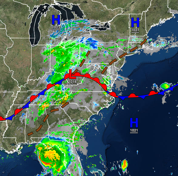
The stationary front will approach the region tonight through tomorrow with scattered to broken cloud cover and isolated to widely scattered showers. Winds will veer from the southeast to the south at 5 to 10 mph. Temperatures will range from the upper 60s to lower 70s for lows and mid-70s to lower 80s along the coast, upper 70s to lower 80s over the interior, and lower to mid-80s in the Delaware River Valley for highs.
The stationary front will linger over the region on Wednesday with waves of low pressure producing widely scattered to scattered showers. Winds will be from the south at 5 to 15 mph. Temperatures will range from the upper 60s to mid-70s for lows and mid-70s to lower 80s over the interior, lower to mid-80s along the coast, and mid to upper 80s in the Delaware River Valley for highs.
The remnants of Tropical Storm Fred will lift into the region on Thursday with periods of rain, heavy at times. Temperatures will range from the upper 60s to mid-70s for lows and lower to mid-70s over the interior and mid to upper 70s along the coast for highs.
Rain will linger into Friday morning followed by scattered showers Friday afternoon. Temperatures will range from the upper 60s to mid-70s for lows and upper 70s to lower 80s over the interior, lower to mid-80s along the coast, and mid to upper 80s in the Delaware River Valley for highs.
A series of weak troughs will pass through the region Saturday and Sunday with scattered to broken clouds with isolated to widely scattered showers. Temperatures on Saturday and Sunday will range from the mid-60s to lower 70s over the interior and lower to mid-70s along the coast for lows and lower to mid-80s for highs.
A cold front will follow on Monday with isolated to widely scattered showers. Temperatures will range from the upper 60s to mid-70s for lows and lower to mid-80s over the interior, mid to upper 80s along the coast, and upper 80s to lower 90s in the Delaware River Valley for highs.