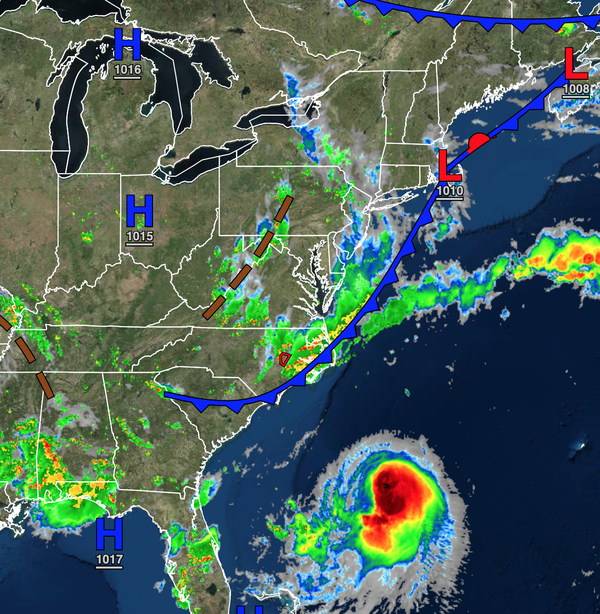
Henri continues to organize this evening over the western Atlantic this evening as the storm approaches hurricane strength. At 5 PM, Henri is a strong tropical storm with winds up to 70 mph and will likely become a category one hurricane by this evening.
The NHC forecast has Henri impacting the region on Sunday with a landfall over eastern Long Island early Sunday afternoon. However, the impacts of Henri will still be felt well to the west of the actual track. Let's break down the impacts.
SATURDAY:
Henri will be approaching the coastal waters while the stationary front will linger along the coast. The combination of tropical moisture and the stationary front along with the upper-level low-pressure system to the west will produce the threat for widely scattered showers which will become more widespread by the afternoon hours throughout the forecast area from the Poconos to eastern Connecticut. The showers and thunderstorms will be capable of intense downpours, frequent
lightning, and wind gusts over 40 mph. Localized flash flooding will be a threat.
SATURDAY NIGHT INTO SUNDAY:
Henri will be entering the coastal waters, the outer bands of Henri will reach the New Jery coast and southern Long Island. These bands will be capable of intense downpours and wind gusts over 30 mph at times. Meanwhile, the combination of the full moon influence and building wave heights will support the threat for minor coastal flooding for the New Jersey coast, Long Island, and Connecticut coast.
SUNDAY:
Henri will make landfall over eastern Long Island around 2 PM. There is potential for Henri to end up further west, closer to New York City. Henri is expected to weaken while approaching the coast but will still be capable of producing tropical storm conditions from Monmouth County, New Jersey through the New York City metropolitan area, Hudson River Valley, and interior southern Connecticut with heavy rainfall, isolated tornadoes, and sustained winds between 40 to 65 mph with
higher gusts. Meanwhile, hurricane conditions are expected for much of Long Island and the Connecticut coast with intense rainfall, isolated tornadoes, and sustained winds between 75 to 90 mph with higher gusts. Coastal flooding will be a threat for the New Jersey coast with a storm surge of 1 to 3 feet and for Long Island and coastal Connecticut with a surge of 2 to 5 feet. Rainfall amounts will range from 1 to 3 inches with localized amounts up to 6 inches, especially on Long
Island and Connecticut.
For the rest of the region, scattered showers and breezy conditions can be expected for eastern Pennsylvania and western New Jersey.
SUNDAY NIGHT THROUGH MONDAY:
Henri will be entrained into the upper-level low-pressure system and meander over central New York. The combination of deep tropical moisture and the upper-level low-pressure system will produce widespread showers and thunderstorms capable of intense downpours, frequent lightning, and isolated tornadoes. The entire Northern Mid Atlantic will be at threat for flash flooding and wind damage in some of these showers and thunderstorms as rainfall rates may exceed 1" per hour at
times.
As the storm evolves more updates will be issued on this volatile and changing event.