Henri will slowly exit today with waves of rainfall continuing with flooding a high threat. A tranquil but hot and humid weather pattern settles in the rest of the week.
TODAY
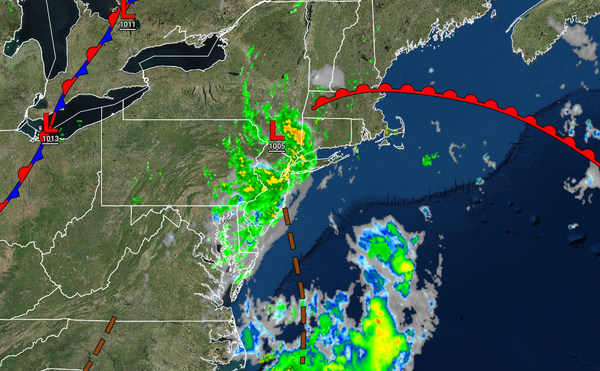
Tropical Depression Henri will slowly pass through the region into New England today with periods of rain, heavy at times. Rainfall amounts of another one to two inches will be possible which may lead to additional flooding. Winds will back to the southwest at 5 to 15 mph. Temperatures will rise into the upper 70s to lower 80s over the interior and along the coast and mid to upper 80s in the Delaware River Valley for highs this
afternoon.
TONIGHT
Henri will lift into New England tonight with a few lingering showers followed by clearing skies. Winds will be from the west-southwest at 5 to 15 mph. Temperatures will fall into the mid to upper 60s over the interior and upper 60s to lower 70s along the coast for lows.
TOMORROW
High pressure will build into the region with clear skies to scattered clouds. Winds will be from the southwest at 5 to 15 mph. Temperatures tomorrow will rise into the lower to mid-80s over the interior, mid to upper 80s along the coast, and upper 80s to lower 90s in the Delaware River Valley for highs.
WEDNESDAY
High pressure will remain in control with clear skies to scattered cloud cover. Some fog will be possible in the morning hours. Winds will be from the south-southwest at 5 to 15 mph. Temperatures on Wednesday will range from the lower to mid-60s over the interior and upper 60s to lower 70s along the coast for lows and mid to upper 80s over the interior and along the coast and upper 80s to lower 90s in the Delaware River Valley for
highs.
THURSDAY
A cold front will pass through the region on Thursday with fog in the morning giving way to isolated to widely scattered thunderstorms in the afternoon. The thunderstorms will be capable of occasional lightning, heavy downpours, and wind gusts over 40 mph. Temperatures will range from the upper 60s to mid-70s for lows and mid-80s to lower 90s for highs.
FRIDAY
Scattered clouds are expected with high pressure passing to the north of the region. Temperatures will range from the upper 60s to mid-70s for lows and mid-80s to lower 90s for highs.
SATURDAY-MONDAY
A wavering frontal boundary will produce broken cloud cover and scattered to widespread showers Saturday through Monday. Temperatures on Saturday and Sunday will range from the upper 60s to lower 70s for lows and upper 70s to mid-80s for highs. Temperatures on Monday will range from the lower to mid-70s for lows and lower to mid-80s on the coast and interior and upper 80s to lower 90s in the Delaware River Valley for highs.